Field Notes
<--2024-03-07 10:00:00 | 2024-03-25 08:45:00-->Other sites visited today: Hill Slough | Bouldin Corn | Bouldin Alfalfa | East End | Mayberry
Phenocam link: Searching...
Gilbert Tract: 2024-03-14 14:50:00 (DOY 74)
Author: Joe Verfaillie
Others: Arman
Summary: Windy, cattail fluff, lost the bird song uSD to the wind, put metal conduit on ADCP cable
| Gilbert Tract 2024-03-14 Arman and I arrived at 14:50 PDT. Happy Pi Day! It was clear and sunny with a strong wind from the north. Cattail fluff was everywhere. Tide was low, water level at about 31cm at 14:10 PST – this is a guess as I didn’t write it down at the time. Arman said he would be happy to contribute to a new locking system for the gate after struggling with the current mess of locks coming and going. Arman refilled the wash reservoir and cleaned the eddy sensors. The middle boardwalk needs replacing. I collected the flux, met and camera data. The 7500 read: 418.5ppm CO2, 278.9mmol/m3 H2O, 20.6C, 101.4kPa, 103.2SS The 7700 read: 2.0ppm CH4, 35.3RSSI – 73.5 after cleaning The wash reservoir was about 60% full – refilled. Arman measured surface conductivity out on the boardwalk Surface, 358.2uS, 12.8C I tried to collect the bird song recordings but as I loosened the uSD card a gust of wind hit and the card flew away. I remove the recorder and will order a new card. At the channel I disconnected the ADCP and we threaded a larger diameter flexible aluminum conduit onto the cable. The conduit runs from the box to about half have down the track. We added a fitting to the box that holds the conduit tightly. After I plugged the cable back in the ADCP seemed to be functioning normally. It complained about the large number of files on the device – but its overall memory is 90% free. I downloaded about six new files. As I was putting things away I discovered I had tide the extra cable in a knot around the conduit. So I unplugged the ADCP again and untangled the cable. Afterwards I connected to the ADCP and it said it was logging – a couple more files created! At the mouth of the channel I climbed down some rocks and managed to reach the water to get a gallon of water for the school field trips next month. We left at 15:38 PDT |
1 photos found

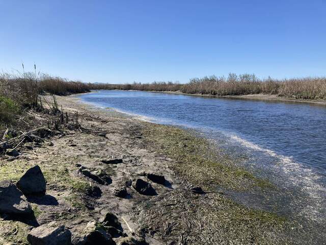
20240314GT_ChannelLowTide.jpg ( 2024-03-14 15:36:14 ) Full size: 1920x1440
Low tide looking west from the channel mouth
8 sets found
Can't check MBWPEESWGT_mixed
Can't check MBEEWPSWEPGT_cam
16 GT_met graphs found
4 GT_flux graphs found
3 GT_adcp graphs found
1 GT_cam graphs found
2 GT_usgs graphs found
No data found for GT_chanexo.

