
Field Notes
<--2021-10-04 09:00:00 | 2021-10-21 10:30:00-->Other sites visited today: Mayberry | West Pond | East End | Bouldin Corn | Bouldin Alfalfa
Phenocam link: Searching...
Gilbert Tract: 2021-10-07 07:45:00 (DOY 280)
Author: Daphne Szutu
Others: Dennis, Ari
Summary: Regular data collection/cleaning, tidal action!, fixed some thermocouple wiring that was in the wrong order, fixed 7700 wash power cable connection, turned cal PAR upside down
| 2021-10-07 Gilbert Tract Dennis, Ari, and I arrived at 7:45 PDT. It was a pleasant fall morning, mild and partly cloudy with a slight breeze. Many bird sounds. This was Ari’s first time at the site since it was set-up. The wetland looks great (very green) and the early morning autumn light is very pretty. Just right of the Gilbert parcel entrance gate, there were several large, dry dirt piles with colors ranging from brown to yellow. We didn’t see any dump trucks, but just in case, after we passed the dirt piles, we drove the lower road along the south levee that is closest to the fence at the southern property damage. The road going north past our tower looked clear, so we drove to the tower and parked just off the road along the Gilbert Marsh Access Berm. The berm has definitely been degraded—the elevation of the berm is lower and there were some wet spots forming already. Gilbert Tract was breached to Little Dutch Slough earlier this week on Monday. Dennis and Ari walked down to the breach site to get some pictures. Some tractors were working at the breach site, maybe dredging the channel. I downloaded met, cam, and USB GHG data. We can see the tidal action in our water level and conductivity sensors. The conductivity data looked weird, like the sensor data was overflowing. I need to check the range of the conductivity sensor and the expected salinity of the tidal water. I also retrieved the miniDOT by pulling on its plastic yellow chain and dragging it through the vegetation to the tower. I downloaded the miniDOT data and swapped its desiccant. Ari put on boots to redeploy the sensor, and in the end the miniDOT was laying on its side in the air, not in the water. We discussed maybe setting up a mini plank or boardwalk to the well so that we can place and access the miniDOT in deeper water. The miniDOT needs a 2m longer leash to reach the deeper water. Ari and Dennis cleaned flux and rad sensors. Dennis turned the cal PAR sn 060831 upside down so it can measure reflected radiation. I downloaded the rad cal kit data. Next time we can move the cal kit to BA (and add the advection HMPs to the intercomparison). The wash reservoir was mostly full, which was weird because the 7700 RSSI was 0. We tested the pump spray, which did not work. We unplugged and replugged the wash power cable at the 7700, which fixed the problem. Nothing looked obviously bad with the wash power cable, but I checked the connection anyways because this has happened before at WP. I re-did some of the thermocouple wiring that was wired in the wrong order. I swapped TC18 and TC19 (now +15cm and +10cm on Profile C), swapped TC24 and TC25 (now -16cm and -32cm on Profile C). I also reversed the order of wires on Profile B so that TC10=+30cm, TC11=+15cm…TC17=-32cm. After the next site visit, I will re-upload the TC data to the database to the correct depths and check that all the data/wiring are as expected. LI-7500 readings: CO2 403ppm H2O 433ppm T 13.7C P 101.4kPa SS 101--> 106 after cleaning LI7700 readings: CH4 1.3ppm RSSI 0--> 86 after cleaning We left at 9:20 PDT. |
5 photos found
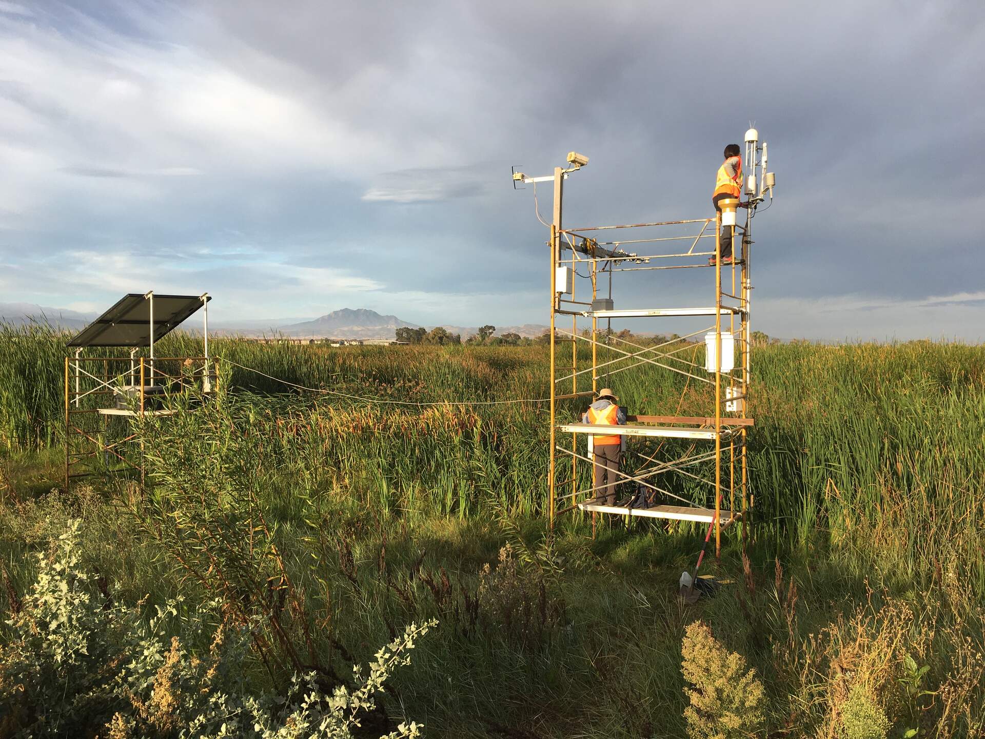
20211007GT_DaphneAri.jpg ( 2021-10-07 08:00:45 ) Full size: 1920x1440
Daphne and Ari in safety vests servicing the site
20211007GT_DegradedBerm.jpg ( 2021-10-07 09:06:35 ) Full size: 1920x1440
Degraded access berm has wet spots (future mud pits)
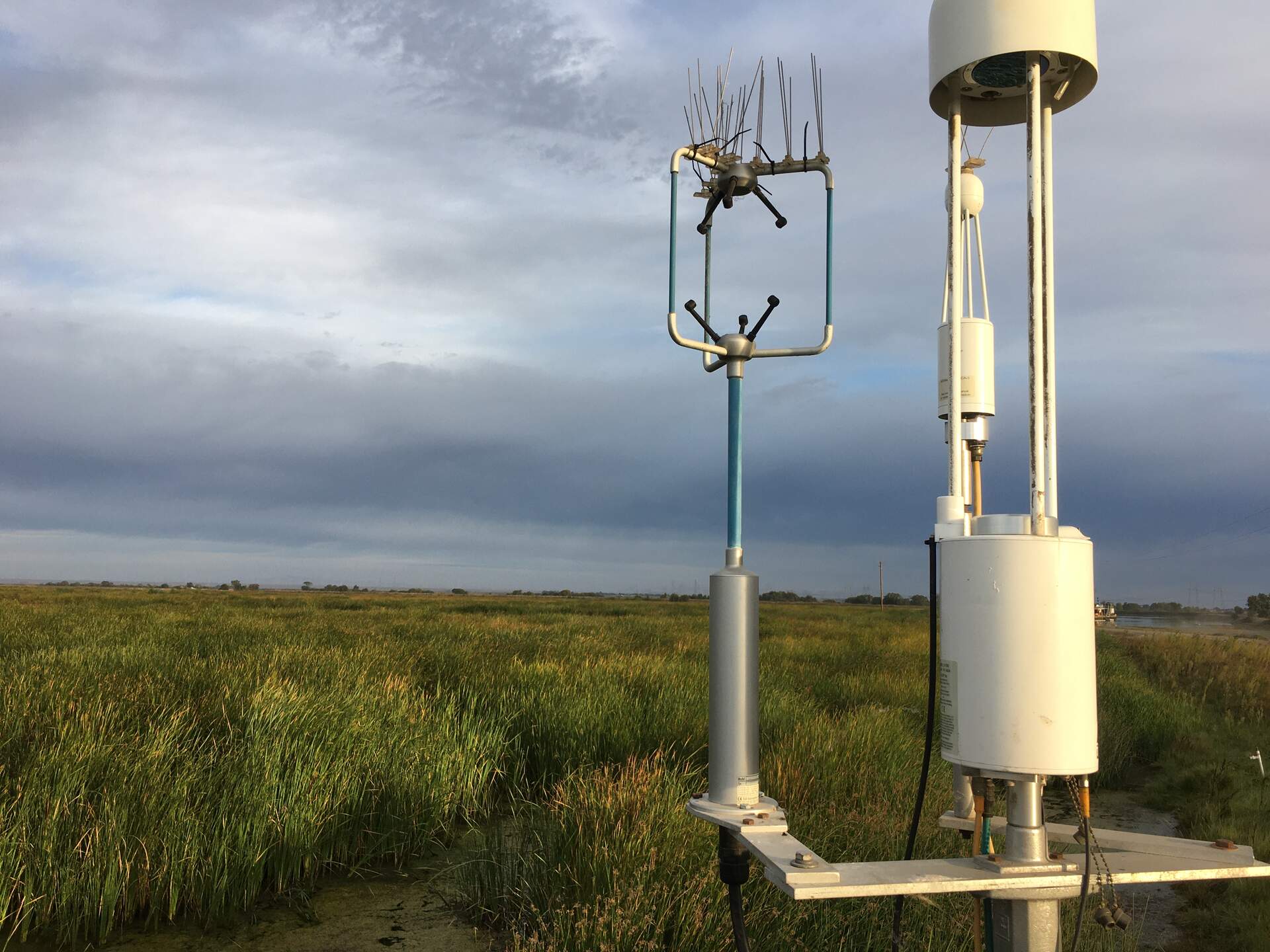
20211007GT_FluxSensors.jpg ( 2021-10-07 07:54:05 ) Full size: 1920x1440
Flux sensors in the early morning light
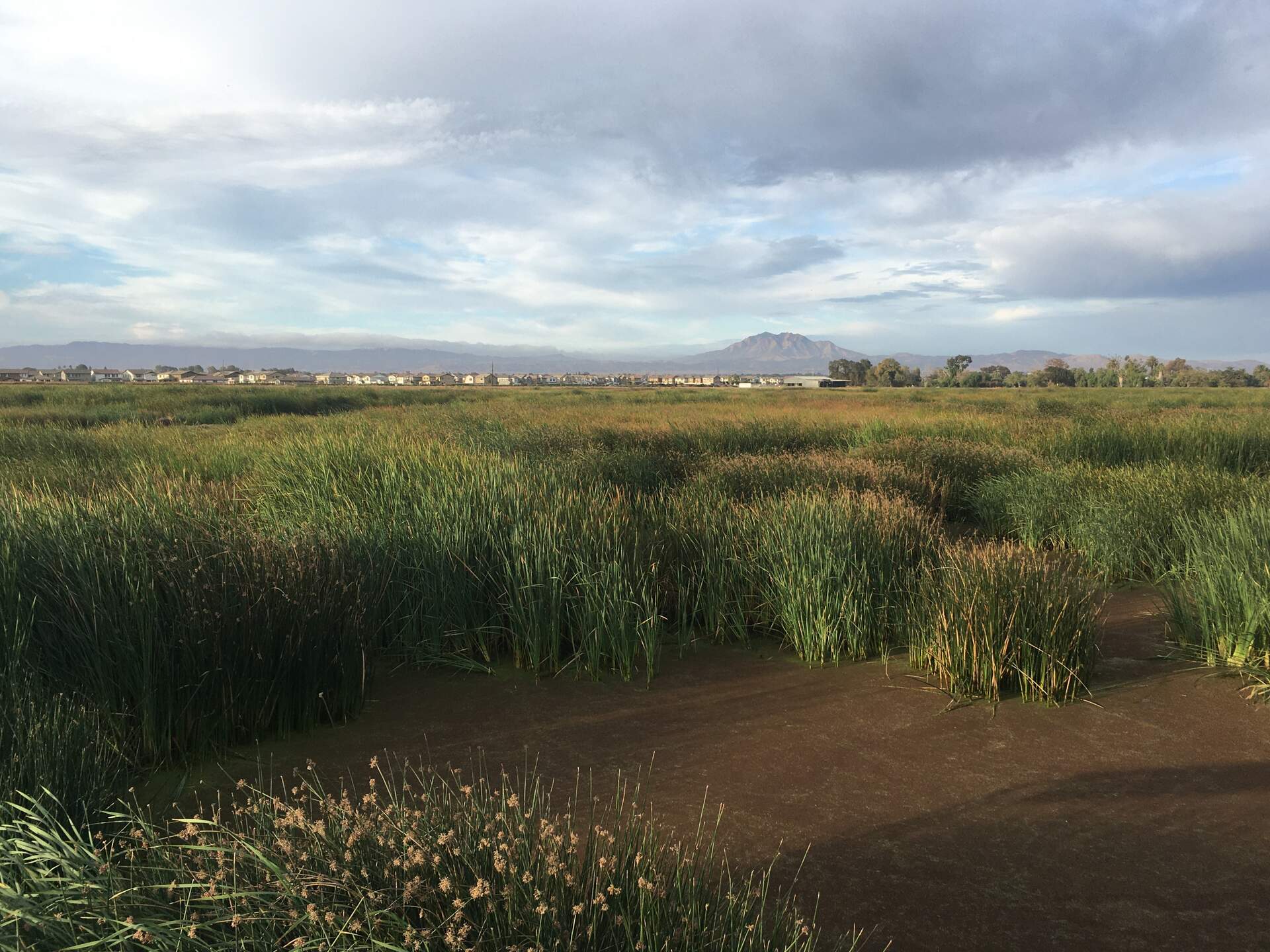
20211007GT_Marsh.jpg ( 2021-10-07 08:18:11 ) Full size: 1920x1440
Mt. Diablo overlooking the Gilbert Tract marsh

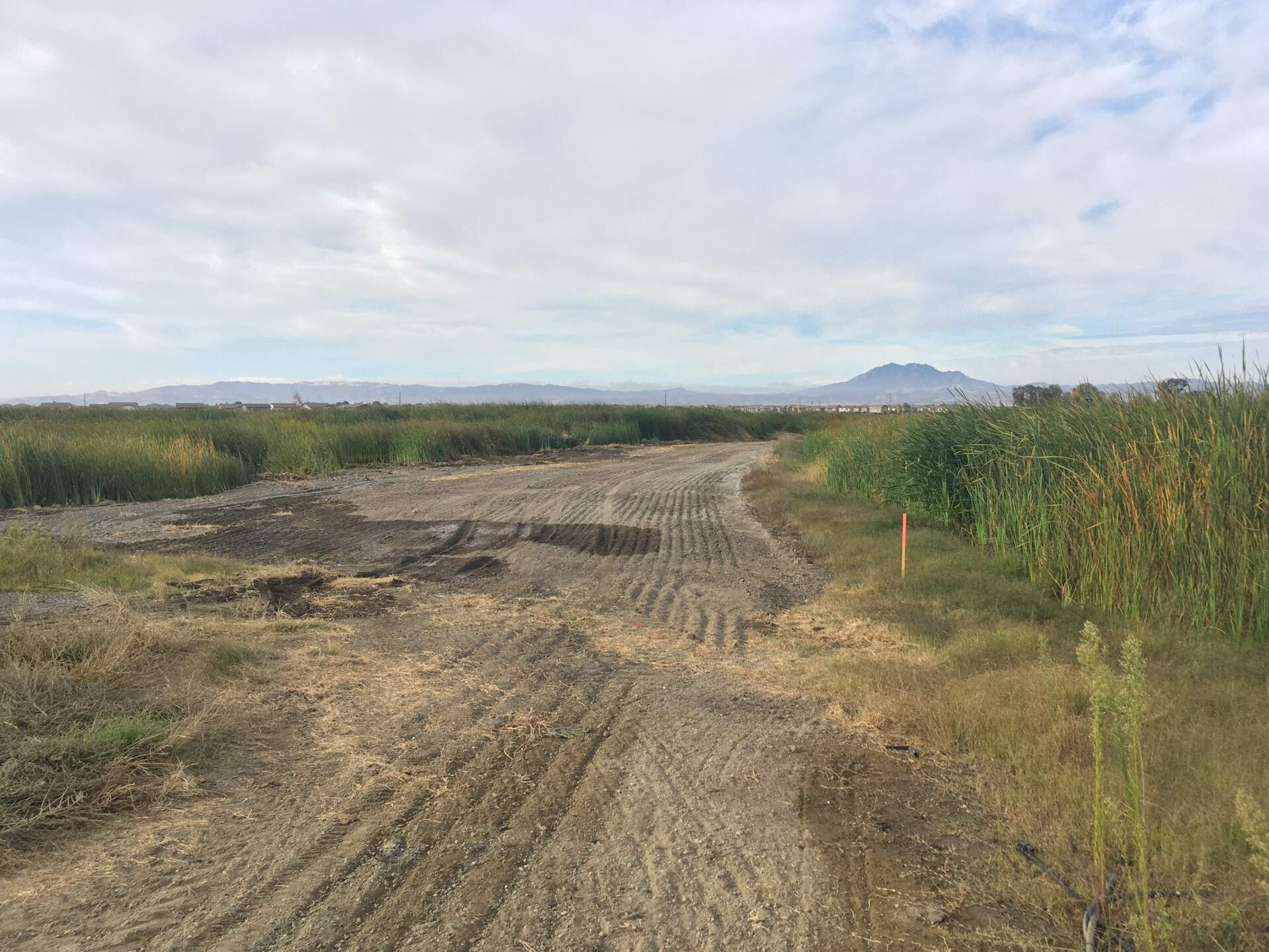
20211007GT_TidalBreach.jpg ( 2021-10-07 08:11:59 ) Full size: 1920x1440
Tractors working at the Gilbert Tract breach site, maybe dredging the channel. This photo was taken 3 days after the breach.
8 sets found
Can't check MBWPEESWGT_mixed
Can't check MBEEWPSWEPGT_cam
16 GT_met graphs found
4 GT_flux graphs found
No data found for GT_adcp.
1 GT_cam graphs found
2 GT_usgs graphs found
2 GT_chanexo graphs found