Field Notes
<--2012-10-18 14:00:00 | 2012-10-30 11:45:00-->Other sites visited today: Sherman Island | Mayberry | Twitchell Rice | West Pond
Phenocam link: Searching...
DWR Corn: 2012-10-25 14:35:00 (DOY 299)
Author: Cove Sturtevant
Others: Joe, Sara, Laurie
Summary: Pulled ground sensors for possible harvest. Downloaded data, took spectral measurements.
| DWR Corn
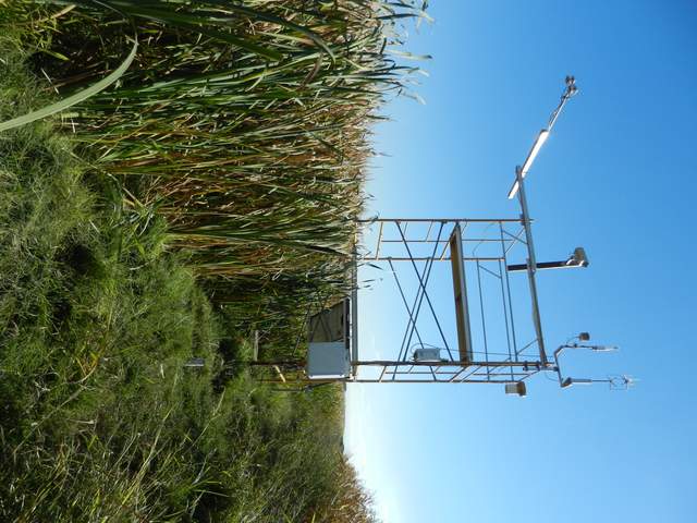
2012-10-25 We arrived about 14:35 PDT. Sara and Laurie took spectral measurements. Joe and I checked the tower, cleaned the sensors, and downloaded the data and camera pics. Tower readings: CO2: 16.3 mmol m-3 H2O: 490 mmol m-3 diag: 248 MET looked good. Joe got a call that they might harvest this week, so we pulled the ground sensors. Joe reinstalled them in the weeds beneath the tower. We also folded the net radiometer 90° to be out of the corn field. It is now over the N-S channel that runs along our walking path out to the tower. |
1 photos found

20121025DC_Tower.jpg ( 2012-10-25 15:12:14 ) Full size: 1920x1440
Eddy tower and cattails along edge of corn field
3 sets found
Can't check DC_mixed
3 DC_mixed graphs found
7 DC_met graphs found
3 DC_flux graphs found

