
Field Notes
<--2024-06-04 14:20:00 | 2024-06-24 12:00:00-->Phenocam link: Searching...
Hill Slough: 2024-06-12 08:50:00 (DOY 164)
Author: Daphne Szutu
Others: Irene, Joe, Arman
Summary: Soil sampling day 1 (HSM_9, HSM_8, HSM_1), regular data collection/cleaning, checked batteries' water, windy
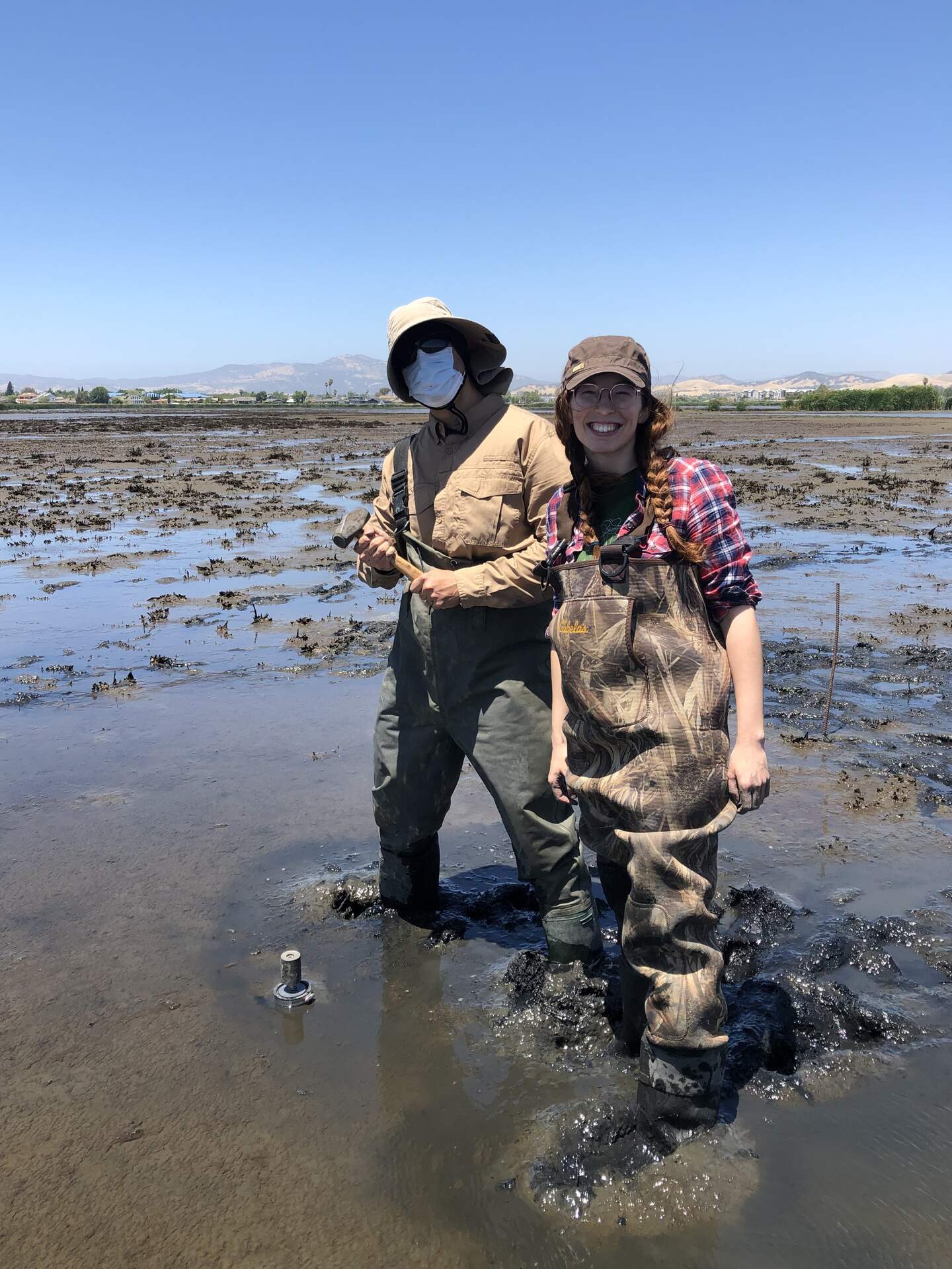
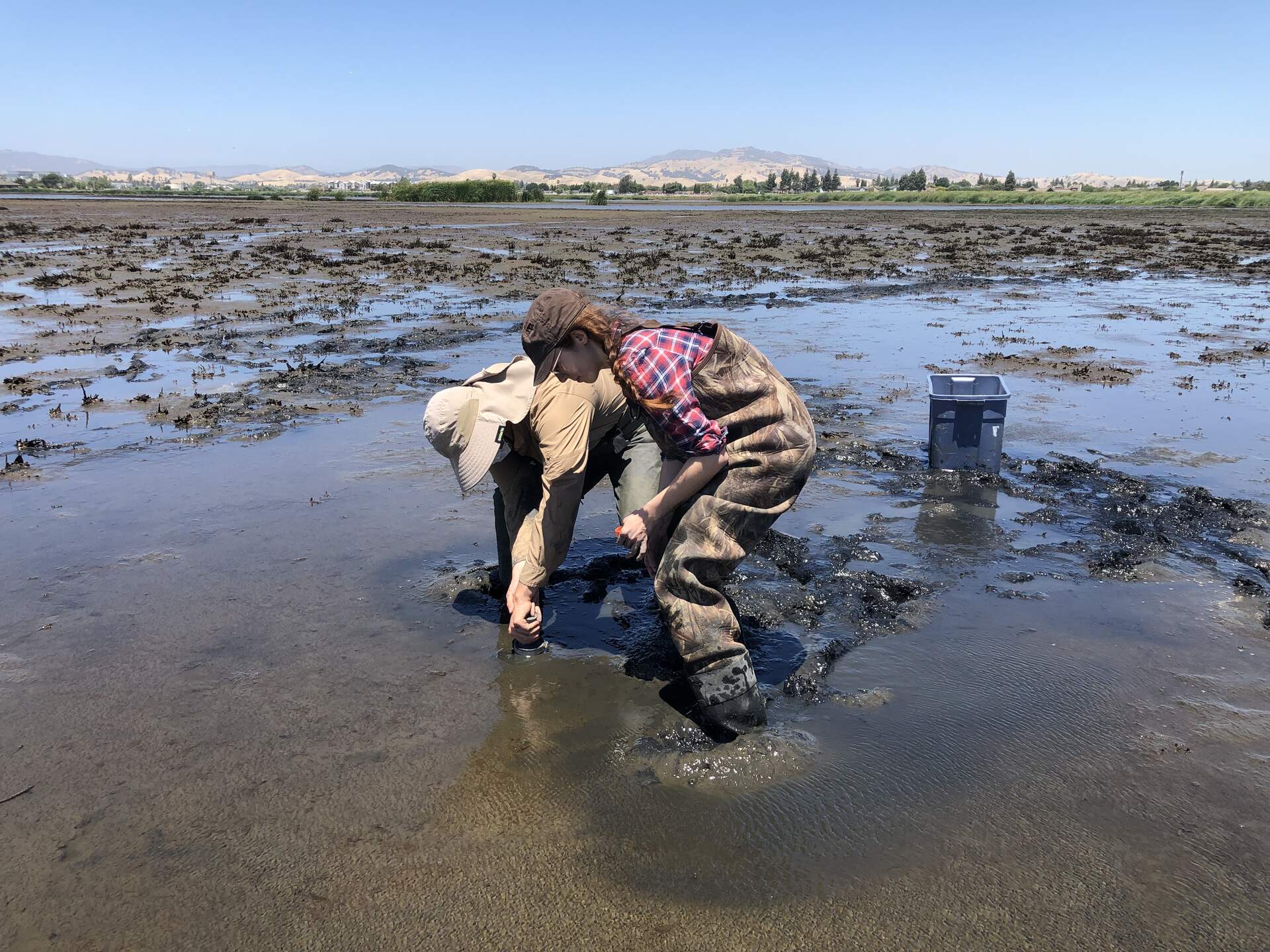
| 2024-06-12 Hill Slough Irene, Joe, Arman, and I arrived around 8:50 PST (9:50 PDT). Tide was ebbing and the staff gauge read 4.95ft at 8:52 PST. It was sunny and mild with a stiff breeze. The sky looked hazy. Today we sampled soils at 3 locations within the wetland as part of Irene’s PhD project. She is resampling the same locations Ari sampled in 2021, before the wetland was flooded. At each location, we planned to take three 30cm cores using acrylic tubes and black push caps we borrowed from Adina. The push cap is attached to the top of the acrylic tube using a hose clamp and is designed to maintain a vacuum in the tube so that soft/wet soils do not immediately slide out of the core when it’s removed from the ground. The core is hammered in using the push cap, then wiggled loose and slowly pulled up. As it’s pulled out of the ground, the bottom of the core is immediately capped with a tight-fitting plastic cap. Some of the cores lost some soil out of the bottom before it was capped. We measured the length of the core and the depth of the hole left behind to get a sense of how much the soil was compacted. At each location, we pounded in a rod to mark the point we thought was closest to 2021 GPS data. From the rod, we took one core to the north, one core to the east, and one core to the south, about 1-2m from the middle rod. We recorded the compass reading and distance from the rod. We chose locations that we had not stepped on or disturbed. HSM_9 – High marsh ecosystem. When we were there, the ground was damp, but some of the low lying areas were squishy. The vegetation was mostly dry grasses, and two plants that iNaturalist identified as alkali heath (green, sparse stems) and curly dock (tall, dark red seed heads). We took two cores in the east direction, because the first core had some fracturing in the bottom 10cm (this was the very first core we took so we were still figuring out our protocol). HSM_8 – Super tall cattails and reeds that we had to push our way through. When we were there, the water was just above the surface. However, we definitely needed boots/waders to get there because we had to walk through some very soft mud to get here. The tall vegetation completely blocked the breeze. HSM_1 — Mud flat with decomposing pickleweed detritus and some visible biofilms in the higher/drier areas. When we were there, the water was just above the surface. The four of us did HSM_9 and HSM_8 together. Arman, Irene, and I did HSM_1 while Joe checked on the solar panels and batteries. He added a bit of water to all of the batteries. None of them were very empty. He washed the solar panels. After we completed the soil samples, we did the regular tower servicing. I downloaded met, cam, and USB GHG data. The wash reservoir was almost empty again—Arman refilled it. Next time I should check the spray to make sure everything is working. Arman and Irene cleaned the sensors and cleared all of the spiderwebs from the sensors. We measured the porewater conductivity and surface water conductivity in the channel. Sample, Temperature-compensated conductivity, Temperature Porewater, 4.66mS, 25.5C Surface, 2966uS, 28.1C The 7500 read: 407ppm CO2, 670 mmol/m3 H2O, 23.3C, 101.1kPa, 94SS – forgot to write after cleaning The 7700 read: 1.98ppm CH4, 83RSSI after cleaning I retrieved the CR1000 and CR23X programs so I could look at them in the lab and figure out why the CTD conductivity data is not getting from the CR23X to the CR1000. We left at 12:45 PST (13:45 PDT). |
10 photos found
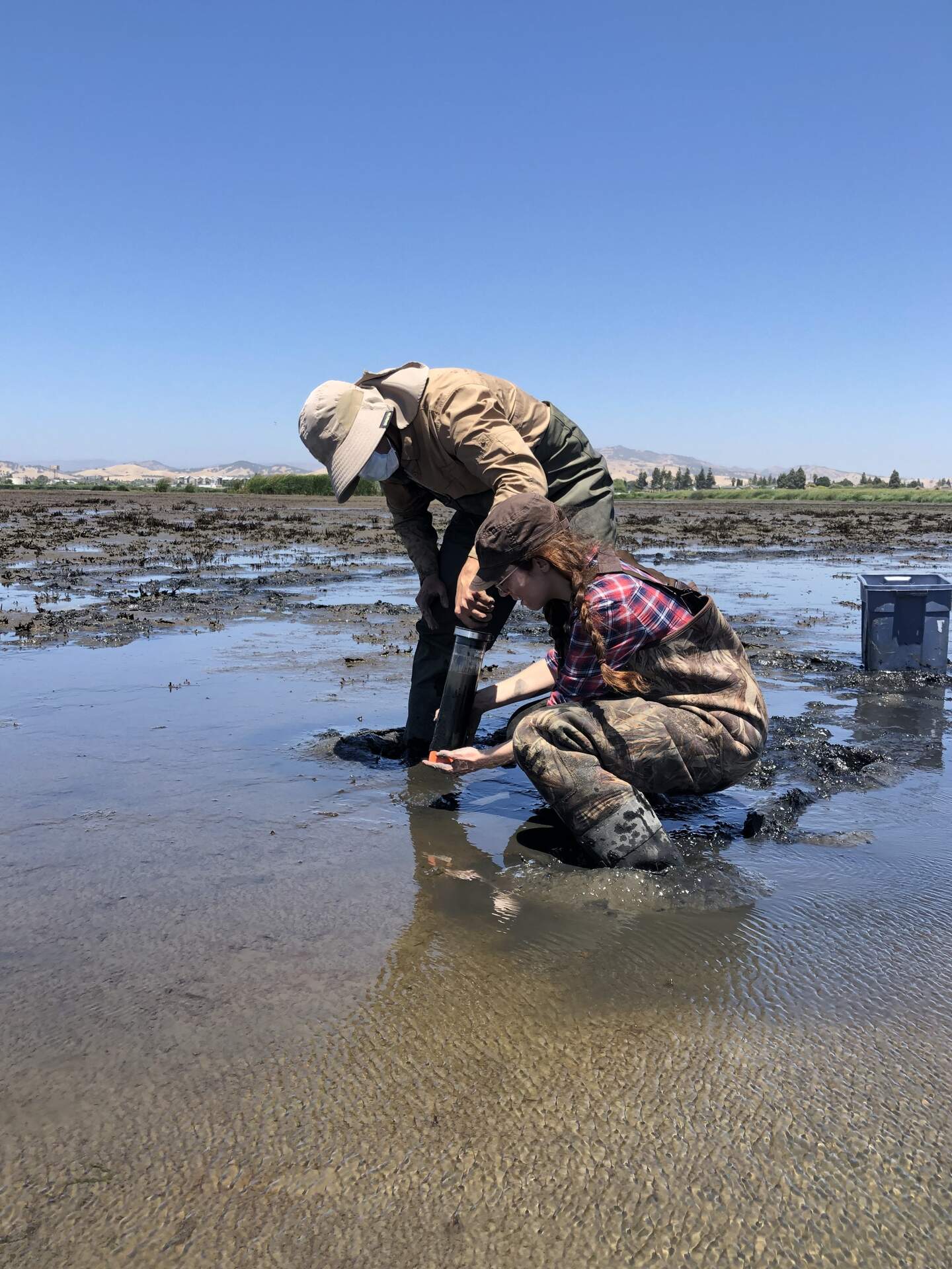
20240612HS_Hsm1Cap.jpg ( 2024-06-12 12:54:19 ) Full size: 1440x1920
Arman and Irene sampling a core at HSM_1. Step three is to quickly cap the bottom of the core to prevent soil from sliding out.

20240612HS_Hsm1Core.jpg ( 2024-06-12 12:54:50 ) Full size: 1440x1920
Arman and Irene sampling a core at HSM_1. Ta-da! Core sampled!
20240612HS_Hsm1Hammer.jpg ( 2024-06-12 12:53:32 ) Full size: 1440x1920
Arman and Irene sampling a core at HSM_1. Step one is to hammer the 30cm acrylic tube into the soil.
20240612HS_Hsm1Removal.jpg ( 2024-06-12 12:54:10 ) Full size: 1920x1440
Arman and Irene sampling a core at HSM_1. Step two is to gently wiggle the rubber cab and remove the tube (with intact core) from the soil.
20240612HS_Hsm9.jpg ( 2024-06-12 10:49:24 ) Full size: 1920x1424
Arman, Joe, and Irene sampling soils at HSM_9.

20240612HS_IreneDaphneArman.jpg ( 2024-06-12 10:23:08 ) Full size: 1920x1440
Irene, Daphne and Arman take soil sample at HSM_9 the upland location
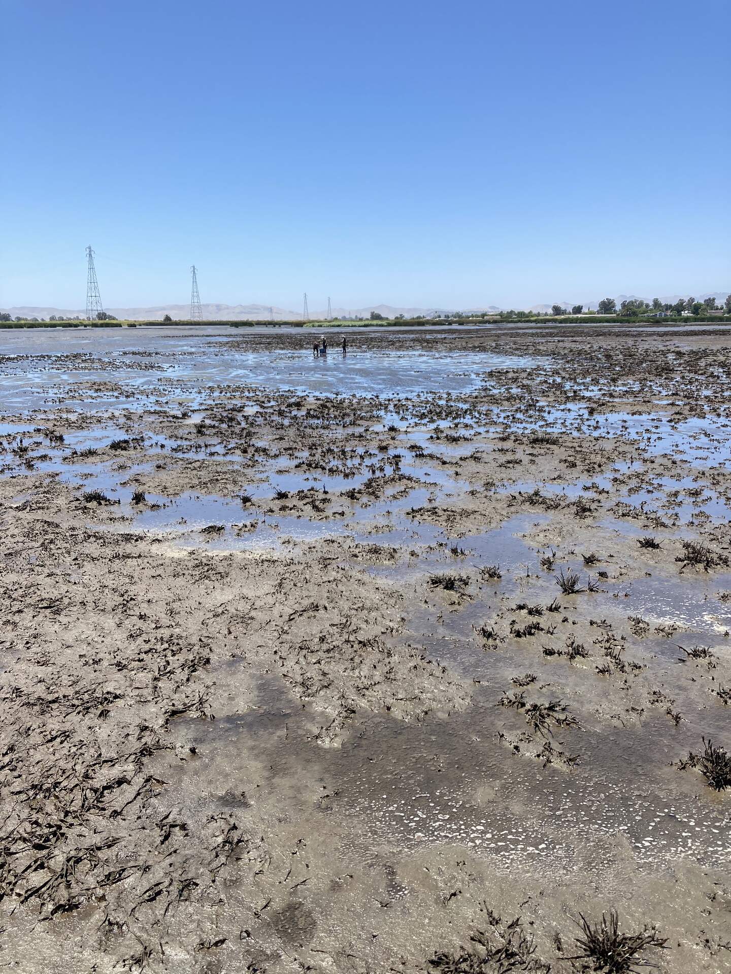
20240612HS_PullingCoresOnMudFlat.jpg ( 2024-06-12 12:57:00 ) Full size: 1440x1920
Irene, Daphne and Arman take soil samples on the mud flat at low tide HSM_1 location
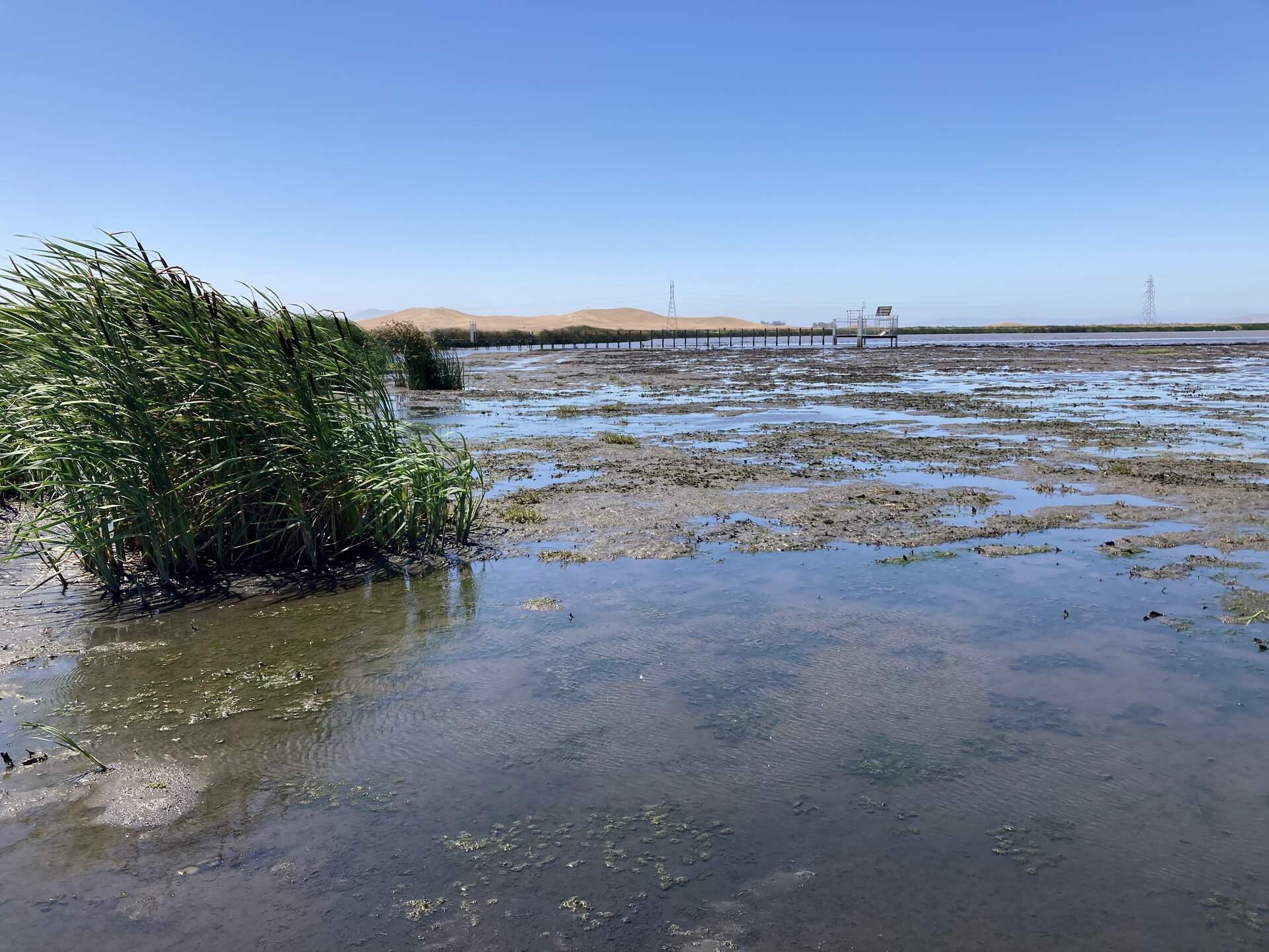
20240612HS_TowerFromReeds.jpg ( 2024-06-12 11:11:38 ) Full size: 1920x1440
View of the Hill Slough tower from the edge of the reeds to the north
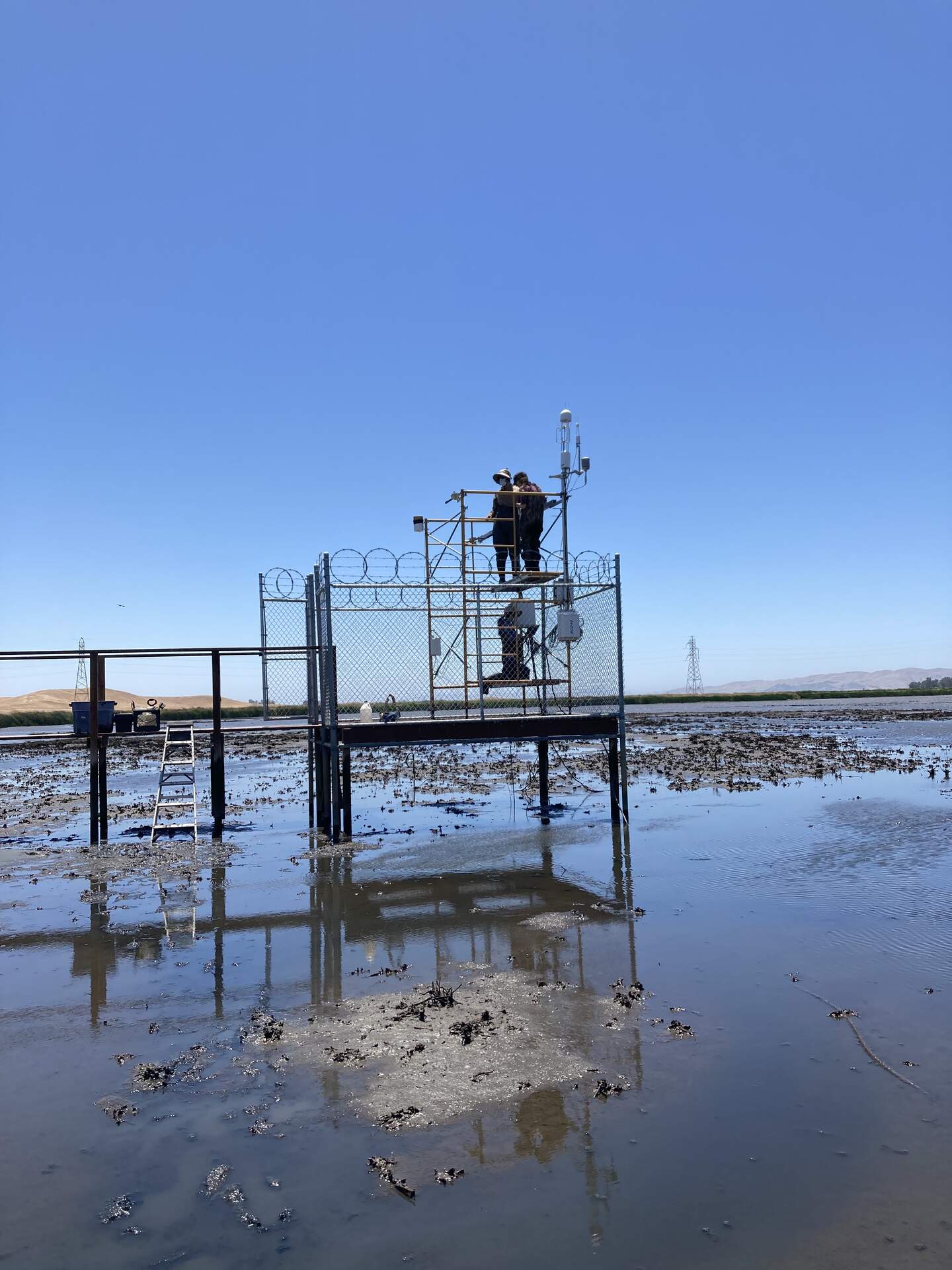
20260612HS_TowerAtLowTide.jpg ( 2024-06-12 13:14:44 ) Full size: 1440x1920
Daphne, Arman and Irene working at the Hill Slough tower
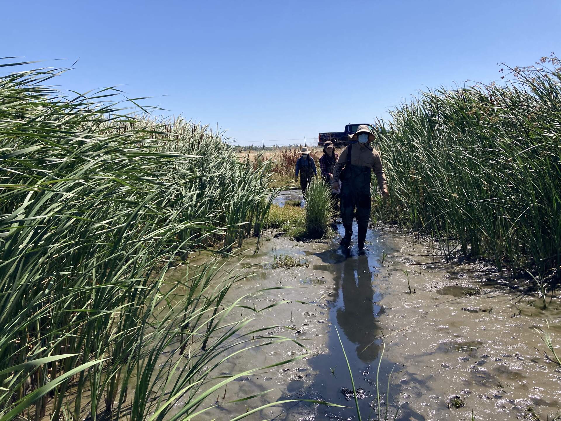
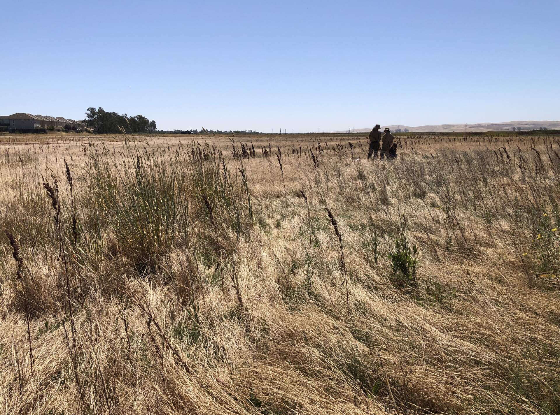
20240612HS_IntoTheMarsh.jpg ( 2024-06-12 11:10:34 ) Full size: 1920x1440
Daphne, Irene and Arman march into the swamp on the northern edge of Hill Slough in search of mud.
4 sets found
21 HS_met graphs found
4 HS_flux graphs found
1 HS_cam graphs found
Can't check HS_Processed
2 HS_Processed graphs found