
Field Notes
<--2023-04-25 10:30:00 | 2023-05-17 08:35:00-->Other sites visited today: East End | Bouldin Corn | Hill Slough
Phenocam link: Searching...
Gilbert Tract: 2023-05-03 10:20:00 (DOY 123)
Author: Daphne Szutu
Others: Joe
Summary: Replaced lower boardwalk, cleared submerged aquatic vegetation by ADCP, adjusted ADCP mount so it points slightly more downward, cool and drizzly
| 2023-05-03 Gilbert Tract Joe and I arrived at 10:20 PDT. On the way here we stopped at Batteries + Bulbs to drop off 8 large batteries + 4 small batteries for core recycling. We also stopped at Home Depot to buy some 15/32 plywood to replace boardwalks. It was mostly overcast (variety of cloud types) and alternating between weak sunlight and errant raindrops. Today was a maintenance day and I also downloaded data. Since it was near low tide, we started at the north bank of the channel to check on the submerged aquatic vegetation. We could see quite the mass of vegetation that stretched for at least 10 m along the bank. However, we weren’t sure exactly where to clear the weeds. Since the two beams are each slanted out 25 degrees from the instrument axis, we could try to calculate where the beams are hitting the northern bank. But should we clear only the areas where the beams are hitting, or the whole area between and around the two beams? It would take a while to try to clear all of the vegetation between the two beams. We left it as is for now. We then drove to Flo on the south bank, passing a few people who were weeding. There was also a lot of submerged aquatic vegetation here which Joe worked on removing with the telescoping rake. I downloaded data, reset the clock to match the laptop time,and then changed the sampling frequency/duration from 300sec to 60sec temporarily so we can track the ADCP status while we adjust the pitch/roll. When we arrived, the roll was about -4 degrees. The negative value means the velocity beams are pointed toward the bottom. However, Mark Stacey and his student Henry Lindekugel’s work show that Beam 2's data is noisy because it is hitting the water surface during low tide. Today Joe and I adjusted Flo’s mount so it is pointed slightly more towards the bottom of the channel; we added two washers to the top mounting bolts. New roll was =-5.0 degrees, the max suggested by the manual. The pitch remained the same at 1.6d egrees. I changed the sampling frequency/duration back to 300sec and restarted data logging. We arrived at the main tower at 12:10 PDT. The staff gauge read 47cm at 11:51 PST. Joe worked on replacing the bottom boardwalk with fresh plywood and using a battery powered skill saw I borrowed from my friend. I downloaded met, cam, and USB GHG data and cleaned flux and rad sensors. The wash reservoir was pretty full so I did not add any water. I fiddled with the extension cable that runs from the tower out to the boardwalk with the water sensors. I wanted to run the cable completely above the canopy,but the cable was not quite long enough. I re-ran it so it’s at least near the top of the canopy, not near the ground. We’ll see how tall the canopy gets. I accidentally pulled some of the water sensors around, but I made sure to return them to about the same height, 4-5cm above the bottom of the staff gauge (i.e., when the staff gauge read 45cm, the sensors were about 40cm below the water surface). The 7500 read: 431ppm CO2, 406mmol/m3 H2O, 17.2C, 100.9kPa,108SS --> 108 after cleaning The 7700 read: 2.1ppm CH4, 52RSSI –> 76 after cleaning I removed the tea bags I had installed in March for the Knightsen field trip, but we didn’t end up using them then. We left at 13:05 PDT. |
3 photos found
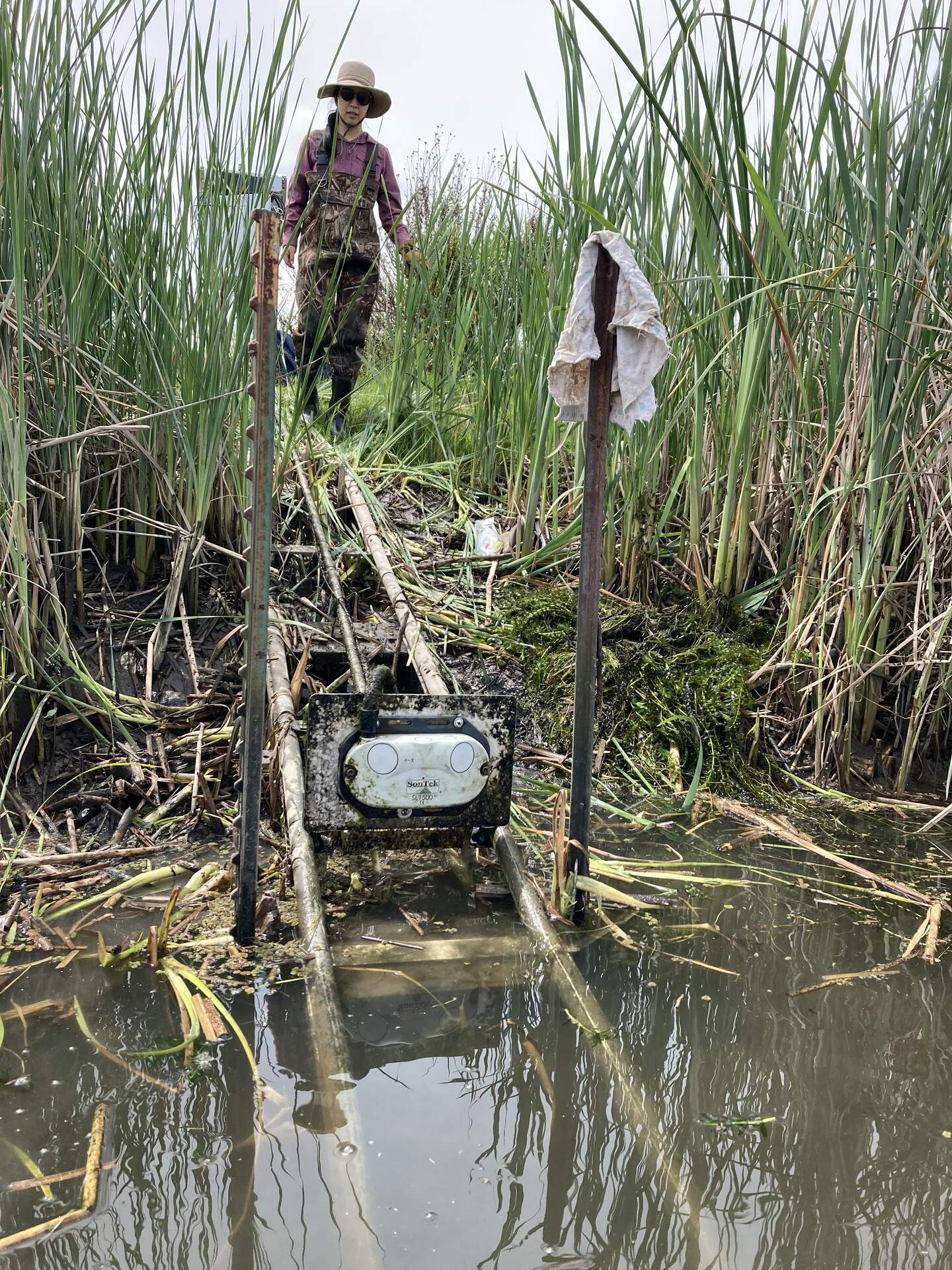
20230503GT_DaphneAndFlo.jpg ( 2023-05-03 11:50:25 ) Full size: 1440x1920
We pulled up the ADCP aka Flo, cleaned and adjusted it.

20230503GT_BiofouledADCP.jpg ( 2023-05-03 11:31:10 ) Full size: 1920x1440
The ADCP aka Flo is in need of cleaning.
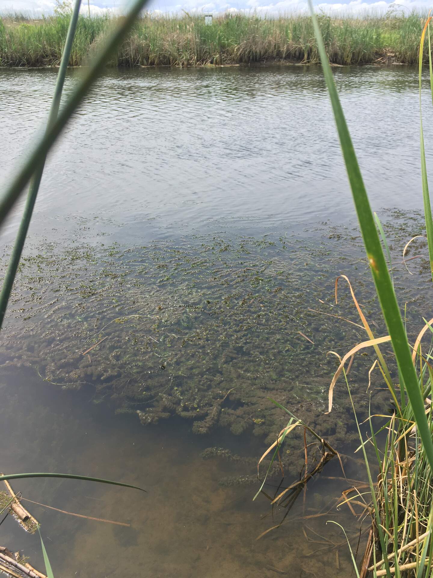
20230503GT_SubmergedWeeds.jpg ( 2023-05-03 10:56:47 ) Full size: 1440x1920
Lots of submerged aquatic vegetation along the southern bank of the Gilbert Tract channel, across from Flo the ADCP
8 sets found
Can't check MBWPEESWGT_mixed
Can't check MBEEWPSWEPGT_cam
16 GT_met graphs found
4 GT_flux graphs found
3 GT_adcp graphs found
1 GT_cam graphs found
2 GT_usgs graphs found
No data found for GT_chanexo.