Field Notes
<--2022-05-27 09:15:00 | 2022-06-28 07:20:00-->Other sites visited today: Mayberry | Bouldin Corn | Bouldin Alfalfa
Phenocam link: Searching...
Hill Slough: 2022-06-08 18:15:00 (DOY 159)
Author: Daphne Szutu
Others: Carlos
Summary: Regular data collection/cleaning, calibrate 7700, skipped camera download--next time
| 2022-06-08 Hill Slough Carlos and I arrived at 18:15 PDT. It was mild but windy. The front gate combo was still scrambled. It was low tide and the ground surface was mucky with some puddles of water. The staff gauge read 3.77 feet at 19:00 PDT (7cm below the bottom of the staff gauge). The miniDOT was barely in the water. From the data it looks like this sensor is getting exposed to air during most low tides. Maybe we can move it to the channel with the EXO. Both the miniDOT and the EXO need to be downloaded independently of the datalogger anyways so no need to be close to the scaffolding. I downloaded the miniDOT data and changed its desiccant. I downloaded met and USB GHG data. Carlos cleaned flux and rad sensors. There was a white film (salt?) on the radiometers. The reservoir was 1/8 empty; we refilled it. I was running out of the laptop battery so I skipped the camera download. Next time I can bring the second laptop to download the photos and upload the new picam code. We calibrated the LI-7700 sn TG1-0211. The calibration looked good. The optics RH was 21% so I left the desiccant as is. We were running out of laptop battery but we were able to finish the calibration. The 7700 heaters were on since 16:00, so I changed the top and bottom heater settings to turn on at 18:00 (PST). This should be fine until fall/winter when it gets foggy. The 7500 read: 400ppm CO2, 680mmol/m3 H2O, 24.6C, 101.1kPa, 95SS – 97 after cleaning The 7700 read: 1.92ppm CH4, 40RSSI – 73 after cleaning We left at 19:00 PDT. Looking at the data back in the lab with Ari, we decided probably both the miniDOT and the eosGP should be in deeper water because they're both being exposed to air during low tides. Maybe I can extend the eosGP cable all the way (20m?) back towards the channel. |
1 photos found

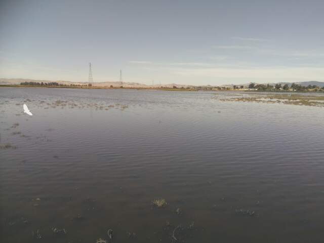
HS_picam_20220609_1045.jpg ( 2022-06-09 10:45:06 ) Full size: 1917x1440
Egret in flight
4 sets found
21 HS_met graphs found
4 HS_flux graphs found
1 HS_cam graphs found
Can't check HS_Processed
2 HS_Processed graphs found

