
Field Notes
<--2020-03-21 15:32:00 | 2020-04-15 00:00:00-->Other sites visited today: Bouldin Alfalfa | Bouldin Corn | East End | Mayberry | Sherman Barn | West Pond
Phenocam link: Searching...
Sherman Wetland: 2020-04-03 17:10:00 (DOY 94)
Author: Daphne Szutu
Others: Mike
Summary: Permanent tower: Regular data collection/cleaning, data dropped a few times this past month--power issue?, first site visit in 3 weeks Temp tower: Regular data collection/cleaning, water level higher, deployed eosGP in shallow water
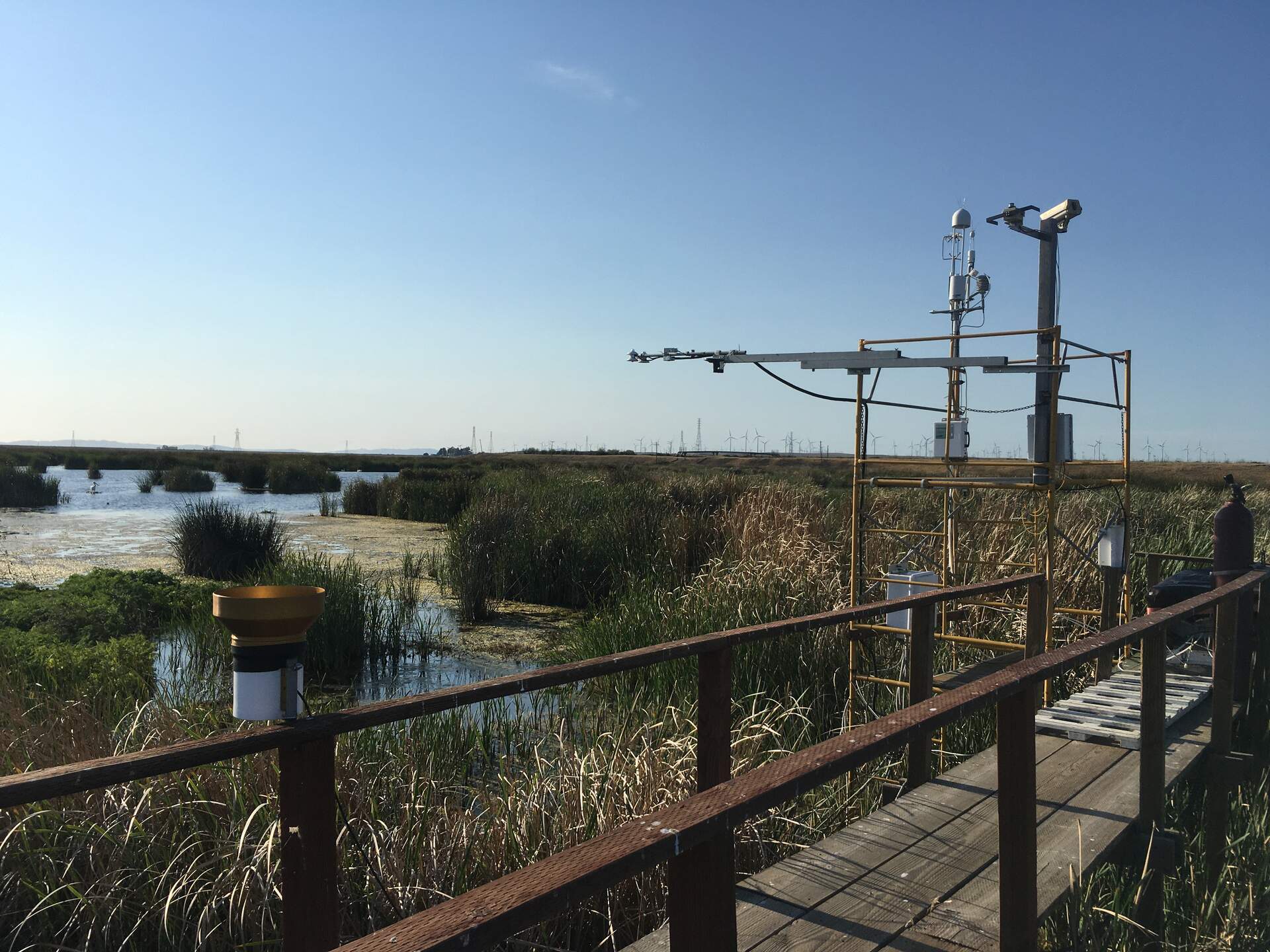
| 2020-04-03 Sherman Wetland Mike and I arrived at 17:10 PDT. It was a sunny and breezy day with blue skies and a beautiful afternoon view of Mt. Diablo. It has been dry recently, but it’s expected to rain for 3 days starting tomorrow. This is the first site visit in 3 weeks. The Bay Area is on the third week of COVID-19 shelter-in-place orders, with at least 4 more weeks to go. The water level was 83 cm. There was again a large white bird (a white Pelican?) with only ½ of its right wing, hanging out in one of the ponds N of our tower. I’ve seen it once or twice before. I downloaded met, camera, USB GHG, and miniDOT data. BattV and eosGP still have weird spikes. I swapped the miniDOT desiccant. The wash reservoir was 2/3 empty; we refilled it. I cleaned flux and rad sensors. LI-7500 readings: CO2 416ppm H2O 367ppm T 20.1C P 101.4kPa SS 95--> 98 after cleaning LI7700 readings: CH4 2.05 ppm RSSI 41--> 85 after cleaning We left at 17:40 PDT. Looking at the data back in the lab, I think there is some power-related issue going on. The met data occasionally has gaps in the middle of the day. It happened only a few, sporadic days in March, but were were losing a few points almost every day in February. The phenocam lost its date since the last site visit, probably when we were tinkering with the power. The clock had reset back to 12/31/1999, so the photo labels on the upper left-hand corner are wrong. I will try to paste a new text box with the correct date/time. 2020-04-03 Sherman Wetland Temporary Tower Mike and I arrived at 16:20 PDT. It was a breezy and cool day with some cirrus clouds. We parked on the gravel road at the base of the levee and walked to the tower. It has been dry recently, but it’s expected to rain for 3 days starting tomorrow. This is the first site visit in a month. The Bay Area is on the third week of COVID-19 shelter-in-place orders, with at least 4 more weeks to go. The water level is coming up under the tower; next visit we might need to move the 2nd boardwalk to give us a trail to the tower. Some cattails and more pepperweed are coming up as well. The water level was at 0 on the staff gauge, and next time we need a bolt or ziptie to hold the staff gauge in place. I moved the eosGP (sn GP20150111) from the air into some shallow water at the tower base. I downloaded met, camera, and USB GHG data. The wash reservoir was waspy but mostly full; I topped it off and left the lid open. I cleaned flux and rad sensors and the picam window, which was covered by bird poop since 2020-03-19. LI-7500 readings: CO2 408ppm H2O 350ppm T 21.8C P 101.7kPa SS 97--> 101 after cleaning LI7700 readings: CH4 2.0ppm RSSI 41--> 74 after cleaning We left at 16:50 PDT. |
4 photos found
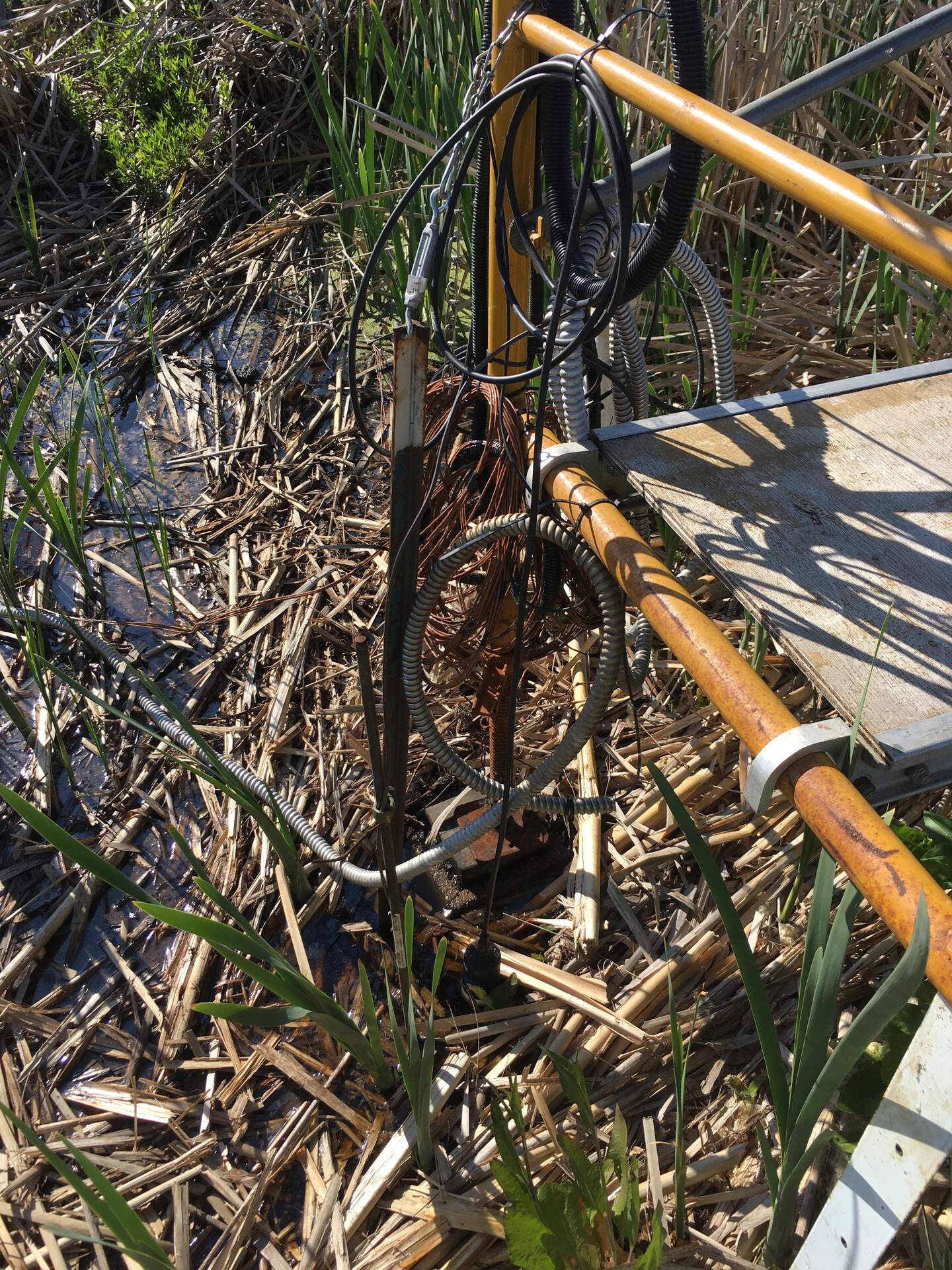
20200403SW_TempTowerEosgp.jpg ( 2020-04-03 16:44:02 ) Full size: 1440x1920
EosGP sensor deployed in shallow water by SW Temp Tower.
20200403SW_TempTower.jpg ( 2020-04-03 16:51:11 ) Full size: 1920x1440
More pepperweed and some cattails coming up by SW Temp Tower.
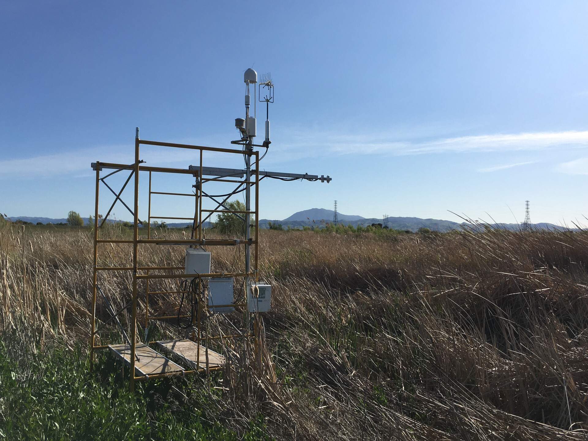
20200403SW_Tower.jpg ( 2020-04-03 17:38:54 ) Full size: 1920x1440
SW tower site is ok after a month.

siwetland_2020_04_02_112450.jpg ( 2020-04-02 11:24:50 ) Full size: 1296x960
Kingfisher (belted kingfisher?)
7 sets found
Can't check MBWPEESWGT_mixed
Can't check MBEEWPSWEPGT_cam
16 SW_met graphs found
4 SW_flux graphs found
Can't check MBSWEEWPBCBA
Can't check SW_Temp
14 SW_Temp graphs found
3 SW_arable graphs found