Field Notes
<--2024-09-19 08:20:00 | 2024-10-11 09:45:00-->Other sites visited today: Gilbert Tract
Phenocam link: Searching...
Mayberry: 2024-09-25 09:10:00 (DOY 269)
Author: Daphne Szutu
Others: Joe
Summary: Replaced bottom scaffolding, regular data collection, lowered picam and dfPAR, disturbed veg-black and veg-blue sippers
| 2024-09-25 Mayberry Joe and I arrived at 9:10 PST. It was mild and sunny with a cool wind. PG&E were working near Sherman Wetland, near the hotspot and further west. Joe thinks they were also removing old power poles. A helicopter was flying back and forth all morning. The sheep gate was still up on the interior levee road on the way to Mayberry. Today was for regular data collection and to replace the other side of the bottom scaffolding. The staff gauge read 58cm. I downloaded met, cam, and USB GHG data. There was a USB error when ejecting the USB, but all seemed fine after resetting the 7550. I cleaned flux and rad sensors. The miniDOT has been temporarily relocated to Gilbert Tract so no miniDOT data for a few weeks. I changed the desiccant for the Campbell water level sensor. The 7500 read: 411ppm CO2, 658mmol/m3 H2O, 20.2C, 100.3kPa, 102SS—106 after cleaning The 7700 read: 2.0ppm CH4, 45RSSI – 71 after cleaning Joe and I swapped out the western side of the bottom scaffolding, which was not obviously broken but well rusted. We had swapped out the eastern side a few weeks ago which had two broken posts. Joe removed the boardwalks from the bottom and second level of scaffolding and used a ratchet strap to support the weight of the boardwalk pathway from the second level of scaffolding (it was previously resting on the bottom scaffolding). We disconnected the power cable because it was twirled through the bottom scaffolding. Joe strapped on two long poles to the second level of the scaffolding and positioned the sheepherder jack between the two poles, under the bottom scaffolding. The poles and jack were supported by concrete piers under the water, and we set up a short ladder in the wetland to reach the upper clamps of the poles. Joe jacked up the whole western side of the scaffolding, and I tightened the upper clamps. After the bottom scaffolding layer was clear, we had to maneuver it free between the plants, the boardwalk, and the lateral arms. We replaced it with a new-ish scaffolding layer we took from West Pond and two screw jack feet we took from Hill Slough. We used bungee cords to attach new screw jack feet to the new scaffolding, and slipped the new scaffolding layer in. We added concrete pavers under the new feet and leveled the tower. We definitely disturbed the vegetated-black and vegetated-blue sipper profiles, but Kyle said she has more or less given up on the sippers this year. I think we should still try to get one last sample from them. Joe tried to remove the old screw jack feet from the old scaffolding piece, but they just broke off the scaffolding. I cleaned up some of the data logger wiring, swapped in a newer power strip for the met box, and checked that all the data seemed reasonable. Joe used a limb saw to trim the 4x4 on the southeast corner of the tower to lower the picam and the dfPAR. This should reduce shading on the incoming radiometers. Joe also trimmed back some of the vegetation along the boardwalk pathway. Joe added tie-downs for the fence posts. We didn’t have the correctly sized conduit hanger so Joe secured the staff gauge at the same height with zip ties. We left at 12:50 PST. |
1 photos found

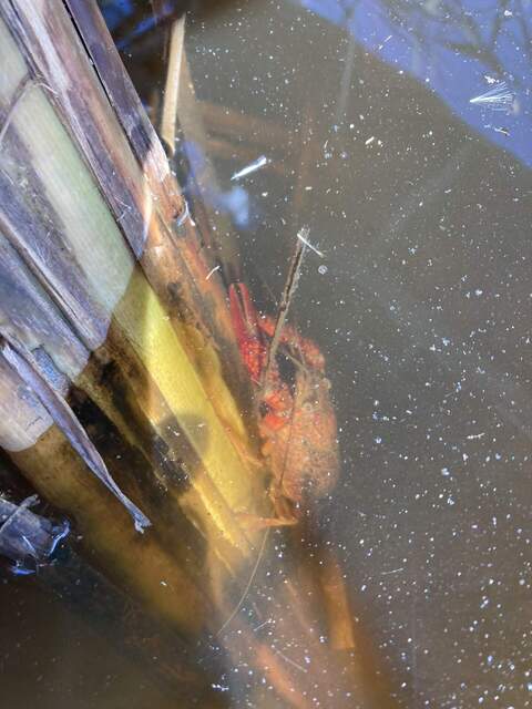
20240925MB_Crayfish.jpg ( 2024-09-25 10:44:48 ) Full size: 1440x1920
Crayfish on cattail stem under water
11 sets found
7 MB_flux graphs found
No data found for MB_met.
28 MB_tule graphs found
Can't check MBWPEESWGT_mixed
1 MB_cam graphs found
Can't check MBEEWPSWEPGT_cam
Can't check SIMBTWEE_met
1 MB_minidot graphs found
Can't check MBSWEEWPBCBA
1 MB_processed graphs found
Can't check MB_fd
1 MB_fd graphs found

