
Field Notes
<--2022-01-20 16:40:00 | 2022-02-18 11:00:00-->Other sites visited today: West Pond | East End
Phenocam link: Searching...
Gilbert Tract: 2022-02-02 12:00:00 (DOY 33)
Author: Joe Verfaillie
Others: Daphne, Ariane
Summary: Windy! Installed track for ADCP, Installed boardwalk at tower, checked HYDROS conductivity and moved water senors to new boardwalk, remove Campbell water level, swapped PAR_in
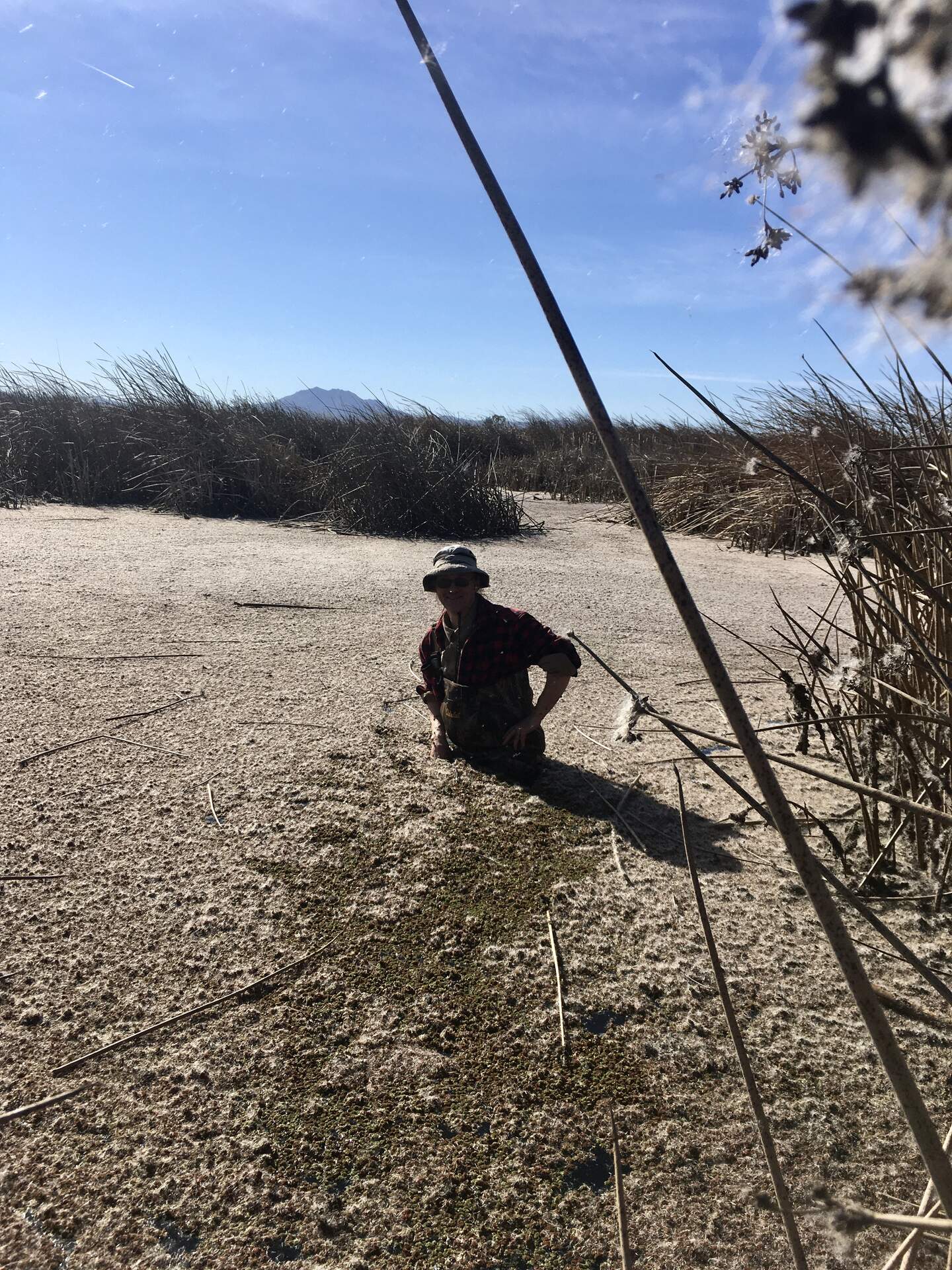
| Gilbert Tract 2022-02-02 Daphne and Ariane and I arrived at about 12:00 noon. It was clear and sunny and super windy with cattail fluff looking like snow in the air. The higher low tide was at about 11:20 today. We were trying to get there at low tide to install the track for the Acoustic Doppler Current Profiler (ADCP). We parked at the end of the levee where the breach is and walked about 50m to the west along the channel. The USGS water sensors are at a point where the channel starts to curve to the south. We chose the relatively straight section about half way between the breech and the USGS sensors (38.005356,-121.670114). We banged the five sections of track together and attached a cinder block to each section. We put cable ties on the bottom end so the trolley car can’t fall off the bottom. Then we carried the track as deep into the water was we could. The top of the track is below the top of the levee and might be under water at high tide. We pounded a couple of T-post in on either side of the track near the middle and tied them to the track with cable ties. We put in another post at the top of the levee for a solar panel, and box. Low tide was at 11:20 and was +1ft and we could definitely see the incoming current while we were there maybe 0.5m/sec. We might be able to do a better job with the track at a lower tide in the future. We got to the tower around 13:30. We brought three sections of boardwalk to install (three sets of two 8ft treated 2x8s tied together at ends and middle and each with six adjustable ABS pipe legs). I had planned to put them where the existing cables ran into the wetland but realized this was directly under the radiometers. Instead we moved south about half way to the solar panels and put it the through the middle of a cattail thicket angling slightly back to the north. The cattail thicket largely blocks the boardwalk from the view of the radiometers and the boardwalk color and material is not all that different than the wetland. At high tide they will be below the water but the last section was as tall as it could go and a little wobbly – longer stiffer legs might be needed. The salinity from the HYDROS21 sensor has not been matching the USGS salinity or our failing Campbell sensor. Ariane tested it with Salinity standards and it seemed to be okay. We took off the copper screen and hose clamp we had added to protect it from fouling to see if that made a difference. It had also been laying in the mud on the bottom. Ariane mounted the HYDROS21, the minidot, and the Eos CO2 sensor on the new boardwalk so they are not laying on the bottom like they were before. She also measured the salinity at that location. Daphne drilled a hole on the boardwalk's pole to secure the miniDOT chain with a zip tie. The handheld YSI recorded 520 uS/cm at this location. All three sensors (HYDROS21, miniDOT and Eos CO2) were mounted so that they are at 15 cm above the soil surface. We removed the Campbell water level sensor sn 20010026 since the HYDROS21 seems to be recording water level just fine. Daphne serviced the tower collecting met, flux, camera and minidot data. She changed the minidot desiccant. Daphne set the Otter cam back to normal motion sensitivity. There is another path south of the solar panels that looks heavily used that might be a good place for another camera. Ariane cleaned the inside of the phenocam window – there was spider poop on it. We moved the camera to clean the window so there may be a slight change in FOV. The original PAR_in sensor has been reading unusual nighttime negative values. We swapped it with one we removed from East End earlier today. PAR sn 140454 came off and sn 990031 went on. We had a really hard time getting the bolts off (stainless bolts but rusted steel nuts). I replaced the bolts with metric K&Z stainless nuts and bolts. We left at about 16:00 |
10 photos found

20220202GT_JoeFlowTrack.jpg ( 2022-02-02 13:11:13 ) Full size: 1440x1920
Joe installing track for Acoustic Doppler Current Profiler at Gilbert Track breech
20220202GT_ArianeSalinity.jpg ( 2022-02-02 14:47:46 ) Full size: 1920x1440
Ariane measuring salinity at GT

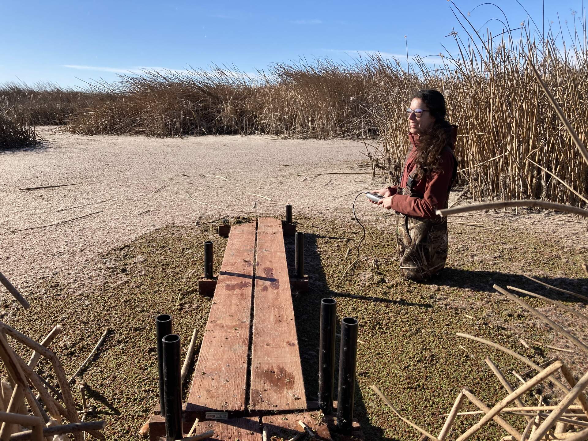
20220202GT_NewBoardwalk.jpg ( 2022-02-02 14:48:14 ) Full size: 1440x1920
We added 7.3m (24ft) of boardwalk

20220202GT_Boardwalk.jpg ( 2022-02-02 15:08:24 ) Full size: 1920x1440
Ari and Joe in the water setting up the boardwalk and hanging the water sensors properly (they used to be laying at the bottom of the pond)

20220202GT_ADCP_mount.jpg ( 2022-02-02 13:16:52 ) Full size: 1920x1440
Joe and Daphne installing ADCP track at channel edge
20220202GT_pool_of_fluff.jpg ( 2022-02-02 13:53:53 ) Full size: 1440x1920
fluff and Azolla.

gilberttract_2022_02_02_144405.jpg ( 2022-02-02 14:45:32 ) Full size: 1296x960
Daphne cleaning sensors
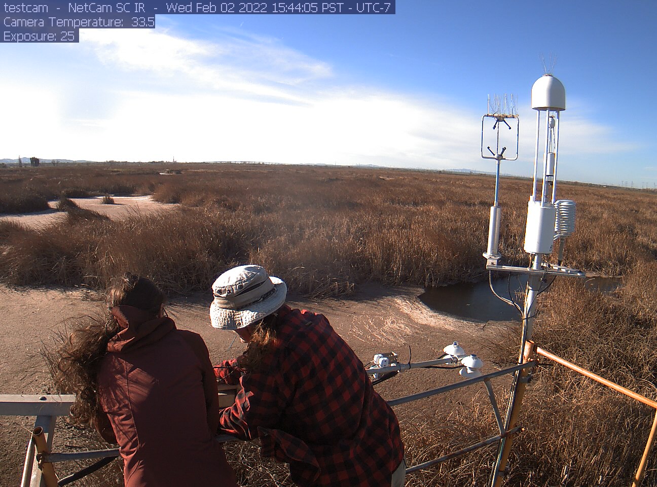
gilberttract_2022_02_02_154405.jpg ( 2022-02-02 15:45:26 ) Full size: 1296x960
Ariane and Joe working on sensors. It's windy!

gilberttract_2022_02_03_084405.jpg ( 2022-02-03 08:45:32 ) Full size: 1296x960
Red wing black bird on radiometer boom. Cattail fluff covering water surface

gilberttract_2022_02_03_171405.jpg ( 2022-02-03 17:15:28 ) Full size: 1296x960
Red wing blackbird on boom
8 sets found
Can't check MBWPEESWGT_mixed
Can't check MBEEWPSWEPGT_cam
16 GT_met graphs found
4 GT_flux graphs found
No data found for GT_adcp.
1 GT_cam graphs found
2 GT_usgs graphs found
2 GT_chanexo graphs found