
Site: Sherman Island (SI) aka US-Snd
2007-01-01 - 2015-05-07
The Sherman Island site is a 38-ha peatland pasture, west of the Delta, that is owned by the state and managed by the California Department of Water Resources. The site is degraded and heavily grazed with ~100 cattle in the area that circumscribes the main field and fetch. The island has been drained and farmed since the late 1800s. The soils of the Delta overlay deep peat that was sequestered over the Holocene period as sea-level rose and flooding of archaic wetlands prevented decomposition of roots and stems. Hence, the upper 10 m of peatland has been lost to decomposition, compaction, and subsidence. Today a mineral soil overlays a peat layer, which coincides with the general depth of the water table.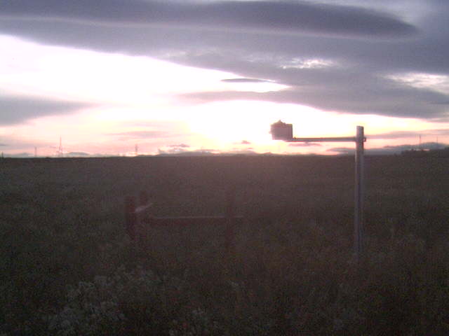
This site was discontinued in 2015 as the land was converted into a restored wetland. A new site was established in 2016 nearby, US_Sne
Last field site visit: more fieldnotes
| 2015-05-12 09:00:00 | Final field notes - the site has been removed |
Latest data processing: more processing notes
| 2024-05-14 | US-Snd data cleaning for dates: 2004-01-04 - 2014-01-14 |
| Processor of record: 2012-12-11 - Not Known 2013-06-20 - Cove Sturtevant 2014-03-04 - Patty Oikawa 2014-04-12 - Cove Sturtevant 2014-05-05 - Patty Oikawa 2014-08-22 - Cove Sturtevant 2014-09-10 - Patty Oikawa 2014-10-08 - Cove Sturtevant 2014-10-08 - Patty Oikawa 2018-08-28 - Daphne Szutu |
Ameriflux Author:
20070405 - Matteo Detto 20070405 - Dennis Baldocchi 20080900 - Joseph Verfaillie 20130620 - Cove Sturtevant 20140304 - Patty Oikawa |
Data Digital Object Identifier (DOI)
AmeriFlux: https://doi.org/10.17190/AMF/1246094
FLUXNET-CH4: https://doi.org/10.18140/FLX/1669692
Equipment Locations
more details
| Equipment | Start Date | End Date | X | Y | Z | Notes |
|---|---|---|---|---|---|---|
| Anemometer | 2007-04-05 | 2015-05-07 | 3.14 | From 2010-05-28 field notes | ||
| 2010-04-06 | 2010-07-01 | 0 | 0 | 6.98 | ||
| Anemometer 2ndTower | 2008-11-25 | 2009-01-07 | 3.14 | Testing CR1000 data collection | ||
| 2009-01-07 | 2009-11-04 | 1.7 | Flux Divergence | |||
| 2009-11-04 | 2010-04-06 | 7.19 | LGR H2O Isotopes | |||
| Barometer | 2007-04-05 | 2015-05-12 | ||||
| Camera | 2010-04-06 | 2010-07-01 | ||||
| CO2 probe | 2010-04-06 | 2014-08-07 | 6 | 11.8 | -0.02 | |
| 2010-04-06 | 2014-08-07 | 6 | 11.8 | -0.08 | ||
| 2010-04-06 | 2014-08-07 | 6 | 11.8 | -0.32 | ||
| 2010-04-06 | 2014-08-07 | 8 | 11.8 | -0.02 | ||
| 2010-04-06 | 2014-08-07 | 8 | 11.8 | -0.08 | ||
| 2010-04-06 | 2014-08-07 | 8 | 11.8 | -0.32 | ||
| 2011-11-08 | 2014-08-07 | 6 | 11.8 | -0.16 | ||
| 2011-12-14 | 2014-08-07 | 8 | 11.8 | -0.16 | ||
| Data Logger | 2010-04-06 | 2010-07-01 | ||||
| Data Logger Fast Rad | 2008-04-28 | 2013-08-21 | ||||
| Data Logger Flux | 2008-11-25 | 2009-07-01 | 2nd tower | |||
| 2009-07-01 | 2015-05-12 | Moved to main tower | ||||
| Data Logger Met | 2007-04-05 | 2015-05-12 | ||||
| Data Logger Soil CO2 | 2010-04-06 | 2014-08-07 | ||||
| Gas Analyzer CH4 | 2010-05-20 | 2010-05-28 | 6.9 | |||
| Gas Analyzer CH4 Closed-path | 2007-04-12 | 2015-05-07 | 3.1 | From 2010-05-28 field notes | ||
| Gas Analyzer CH4 Closed-path 2ndTower | 2009-11-04 | 2010-02-04 | ||||
| Gas Analyzer CH4 Open-path | 2010-05-28 | 2010-06-16 | 0.16 | 0.16 | 3.08 | From 2010-05-28 field notes |
| 2010-07-08 | 2010-07-28 | 0.16 | 0.16 | 3.08 | From 2010-05-28 field notes | |
| Gas Analyzer CO2/H2O | 2007-04-05 | 2015-05-07 | 2.77 | From 2010-05-28 field notes | ||
| 2010-04-06 | 2010-07-01 | 6.98 | ||||
| Gas Analyzer CO2/H2O 2ndTower | 2008-11-25 | 2010-03-18 | ||||
| Heat Flux Plate A | 2007-03-22 | 2015-05-07 | -0.01 | |||
| Heat Flux Plate B | 2007-03-22 | 2015-05-07 | -0.01 | |||
| Heat Flux Plate C | 2007-03-22 | 2015-05-07 | -0.01 | |||
| Interface CFM | 2010-04-06 | 2010-07-01 | ||||
| Interface CFM 2ndTower | 2008-11-25 | 2010-02-04 | ||||
| LED sensor | 2009-11-24 | 2009-12-01 | 2.57 | Temporary location due to missing parts | ||
| 2009-12-01 | 2015-05-12 | 2.57 | Pointed south at end of radiation boom | |||
| Multiplexer Met | 2007-04-05 | 2015-05-12 | ||||
| Multiplexer Thermocouple | 2007-04-05 | 2015-05-12 | ||||
| Net Radiometer | 2007-04-05 | 2015-05-12 | ||||
| Net Radiometer 4-way | 2007-03-27 | 2015-05-07 | 2.57 | From 2010-05-28 field notes | ||
| PAR Sensor Diffuse | 2007-04-20 | 2015-05-12 | Rotating shadow band | |||
| PAR Sensor Incoming | 2007-03-27 | 2015-05-07 | 2.59 | From 2010-05-28 field notes | ||
| PAR Sensor Reflected | 2007-03-27 | 2015-05-07 | 2.39 | From 2010-05-28 field notes | ||
| Precipitation | 2007-04-05 | 2015-05-07 | 2.59 | From 2010-05-28 field notes | ||
| RH & Temp | 2007-03-22 | 2015-05-07 | 2.59 | From 2010-05-28 field notes | ||
| Soil Moisture Probe A | 2007-04-05 | 2015-05-12 | -0.2 | |||
| Soil Moisture Probe B | 2007-04-05 | 2015-05-12 | -0.3 | |||
| Soil Moisture Probe C | 2007-04-05 | 2015-05-12 | -0.1 | |||
| Soil Moisture Probe SoilCO2 B | 2012-07-19 | 2014-08-07 | -0.02 | West Profile | ||
| Soil Moisture Probe SoilCO2 C | 2012-08-02 | 2014-08-07 | East profile | |||
| Soil Moisture Probe SoilCO2 D | 2012-08-02 | 2014-08-07 | East profile | |||
| Thermocouple A Profile | 2007-03-22 | 2015-05-07 | -0.02 | |||
| 2007-03-22 | 2015-05-07 | -0.04 | ||||
| 2007-03-22 | 2015-05-07 | -0.08 | ||||
| 2007-03-22 | 2015-05-07 | -0.16 | ||||
| 2007-03-22 | 2015-05-07 | -0.32 | ||||
| 2007-03-22 | 2015-05-07 | -0.5 | ||||
| Thermocouple B Profile | 2007-03-22 | 2015-05-07 | -0.02 | |||
| 2007-03-22 | 2015-05-07 | -0.04 | ||||
| 2007-03-22 | 2015-05-07 | -0.08 | ||||
| 2007-03-22 | 2015-05-07 | -0.16 | ||||
| 2007-03-22 | 2015-05-07 | -0.32 | ||||
| 2007-03-22 | 2015-05-07 | -0.5 | ||||
| Thermocouple C Profile | 2007-03-22 | 2015-05-07 | -0.02 | |||
| 2007-03-22 | 2015-05-07 | -0.04 | ||||
| 2007-03-22 | 2015-05-07 | -0.08 | ||||
| 2007-03-22 | 2015-05-07 | -0.16 | ||||
| 2007-03-22 | 2015-05-07 | -0.32 | ||||
| Water Level | 2007-03-22 | 2015-05-07 | -0.75 |
Data Streams:
more data
| Code | First Day | Last Day | Description |
|---|---|---|---|
| SI_amp | 2007-01-01 | 2015-01-01 | Data submitted to Ameriflux |
| SI_cam | 2007-10-04 | 2015-05-02 | Digital number data from Sherman Island webcam/autocamera Phenocam archive |
| SI_fastrad | 2008-04-28 | 2010-02-18 | 30min averages of CNR1 and diffuse PAR from CR10x2 collected at 2sec intervals. |
| SI_flx | 2007-04-05 | 2015-05-07 | 30 minute averages of the high speed data channels recorded by the CR1000. |
| SI_met | 2007-04-05 | 2015-05-07 | |
| SI_mp | 2010-06-16 | 2015-05-07 | Data from the Sherman Island Moisture Point probes. |
| SI_processed | 2007-04-05 | 2015-05-06 | Fluxes and derived values from Level 1 processing |
| SI_processed3 | 2010-01-01 | 2015-05-06 | Gap filling and partitioned data from Level 3 processing |
| SI_soilco2 | 2010-04-06 | 2014-08-07 | Soil CO2 from Vaisala GMP220 probes and collected on a CR23X in 30 minute averages. |
Metadata and Data Sets:
more data
| Id | Type | Site | Dates | Frequency | Title | Description |
|---|---|---|---|---|---|---|
| 6 | Lidar | SI, MB, SB | 2007-02-01 | Once | Sherman Island part of DWR Delta wide 2007 Lidar flight | These data are from LIDAR flights of the Sacramento-San Joaquin Delta conducted during late January and February of 2007. The work was conducted under contract issued by California Department of Water Resources to URS Corporation. All data are registered to UTM Zone 10, NAD83, vertical datum NAVD88. The elevation units in the point files are in meters. The elevations for the ESRI grids are in decimeters (done to allow integer type grids to save file size). The bare earth grid is of one meter resolution. The accuracy specifications are as follows: Vertical accuracy: 95% at 0.6’ (<18.5cm) and 90% at 0.5’ (15cm) Horizontal accuracy: 1.0’ (30cm), 1 sigma. |
| 1 | Soils | SI | 2007-11-08 | Once | Sherman Island Soil Profiles | Soil profiles six location from 0-60cm, Carbon, Nitrogen, Bulk Density, pH, Cation Exchange Capacity, Volumetric Water Content Method: Used trencher to dig ~6m trench on north side of enclosure, Dug 2 parallel 3" trenches about one foot apart and dug out space between them with a shovel. The profiles are about 1 m from each other, and there are five in total. Yit took 0-10 cm surface samples with his sampling apparatus (un-even volume precision). From field notes, samples were taken on several dates by Ben Runkle from 2007-10-11 to 2007-12-18. |
| 29 | Soils | SI | 2010-04-29 | Once | Sherman Island Levee Soil Sampling | Jacyln took soil samples from tidal area at the levee location. Not sure where the data is. |
Cospectra_Comparison_Delta.pdf - Plots of cospectra from the Delta sights
UCB_LI7700Testing.pdf - Report on the testing of the LI-7700 in the Delta
2013_SI_AmerifluxReport.pdf - Ameriflux intercomparison from April 8-18, 2013 at Sherman Pasture
2008_SI_AmerifluxReport.pdf - Ameriflux intercomparison from April 7 - 17, 2008 at Sherman Pasture
ATI_Gill_compare_SI_WP_TT.pdf - An ATI orthogonal sonic was borrowed from the Goldstein Lab and intercompared with Gill sonics at Sherman Island, West Pond and Tonzi Ranch.