
Biomet Gallery
All Photos | Site Cam Gallery | Key words
Large Photos
Page: [1]
| ID | Name | Location | Date | Size | Camera | Thumb |
|---|---|---|---|---|---|---|
| 260 | 20100902TZ_SapFlowSouthTrees.jpg Tress used for south sap flow station |
Tonzi | 2010-09-02 11:39:32 | 3648x2736 | Canon PowerShot A480 | 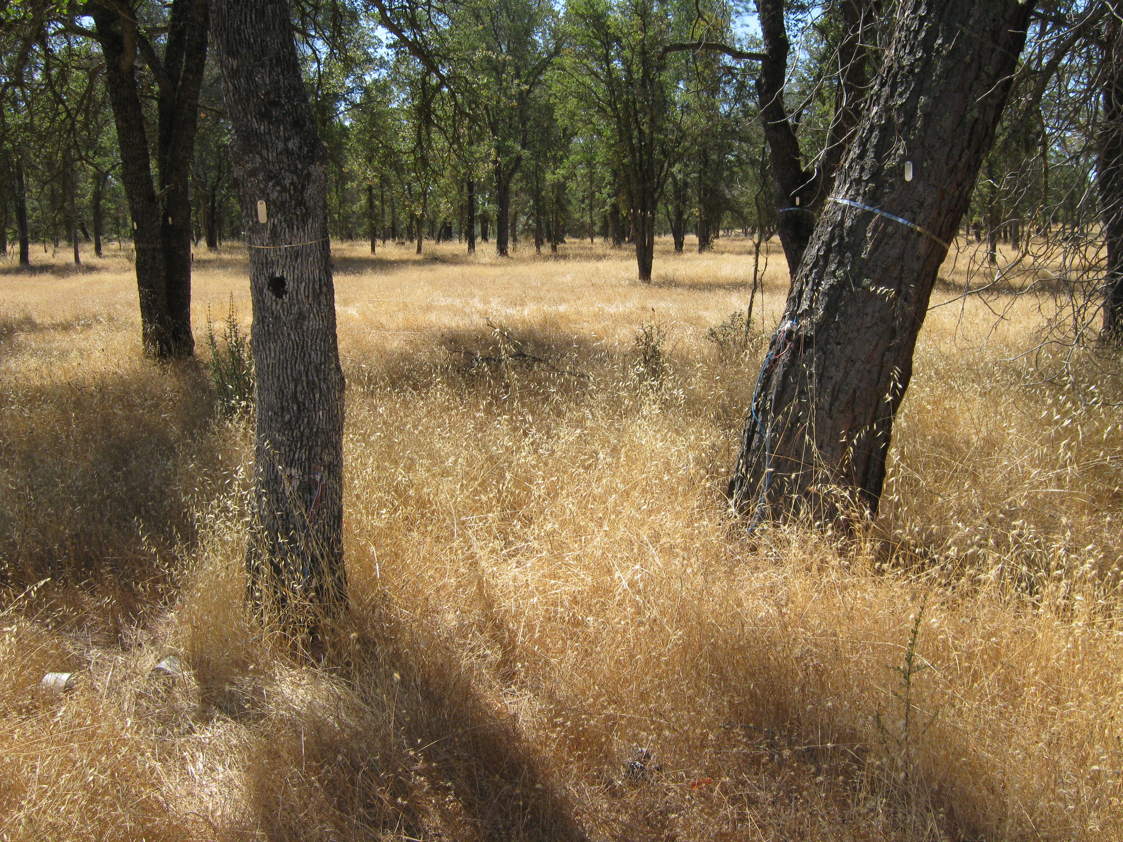 |
| 541 | 20110118TW_GeneratorSpecs.jpg Specs on the generator used to power the rice site |
Twitchell Rice | 2011-01-18 13:24:57 | 2560x1920 | DMC-TZ1 | 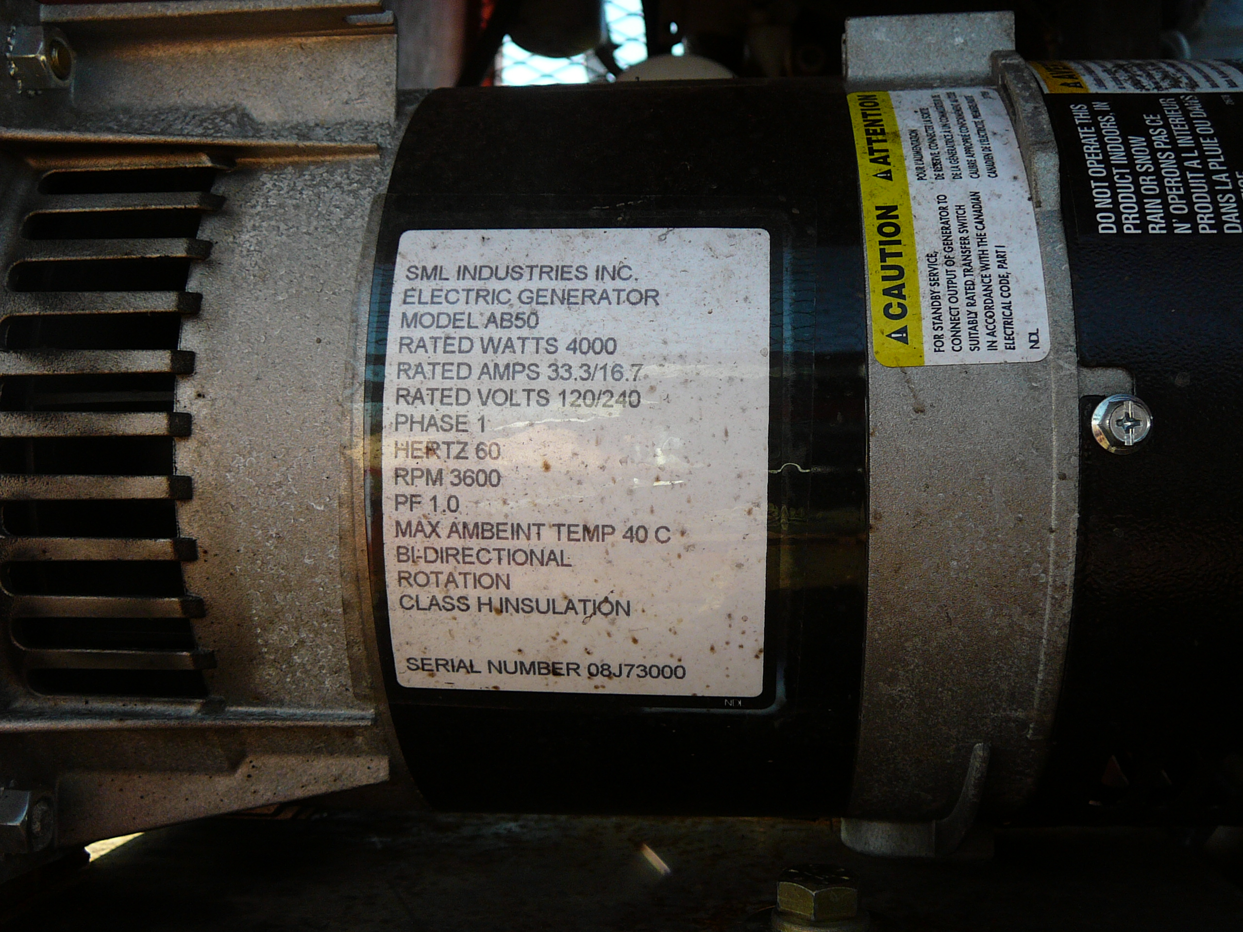 |
| 4670 | 20170426BC_Trench.jpg We used a rented trencher to dig a 12in deep trench from the northwest corner of the porch, just past the end of a north-south drainage ditch to the tower location. It crosses both roads at a diagonal. The power cable (two conductor #10 with ground UF-B direct burial cable) is in 3/4in plastic conduit at the bottom of the trench. |
Bouldin Corn | 2017-04-26 12:48:29 | 1440x1920 | iPhone SE | 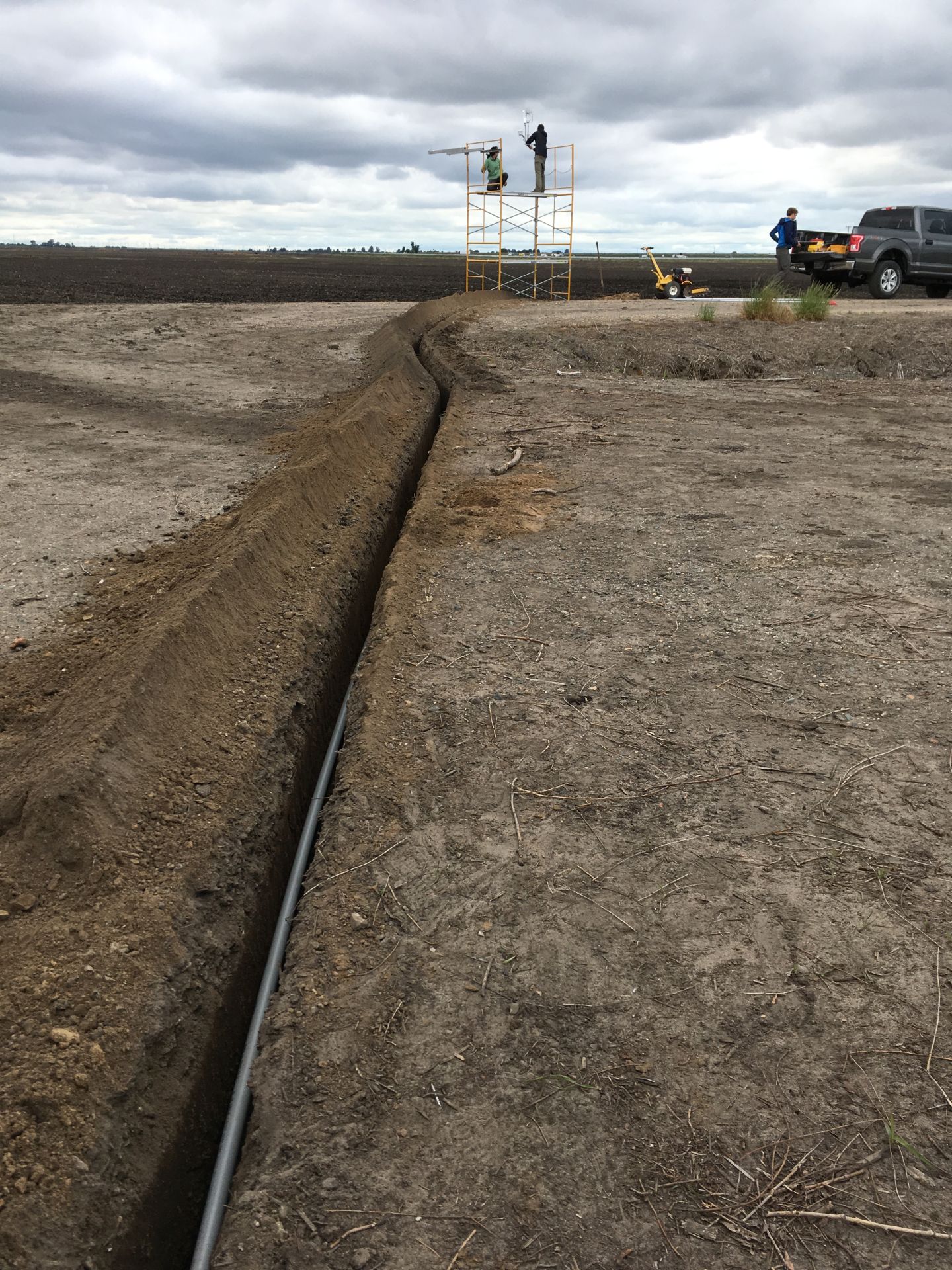 |
| 5593 | siwetland_2021_04_15_091405.jpg Inflatable raft used during methane hotspot sampling |
Sherman Wetland | 2021-04-15 09:15:38 | 1296x960 | StarDot NetCam SC |  |
| 5813 | 20220202GT_Boardwalk.jpg Ari and Joe in the water setting up the boardwalk and hanging the water sensors properly (they used to be laying at the bottom of the pond) |
Gilbert Tract | 2022-02-02 15:08:24 | 1920x1440 | iPhone SE (1st generation) |  |
| 6128 | bouldinalfalfa_2022_11_02_123130.jpg Joe decommissioning the advection experiment and removing the long pole used to mount sensors at 6m height |
Bouldin Alfalfa | 2022-11-02 13:32:34 | 1296x960 | StarDot NetCam SC | 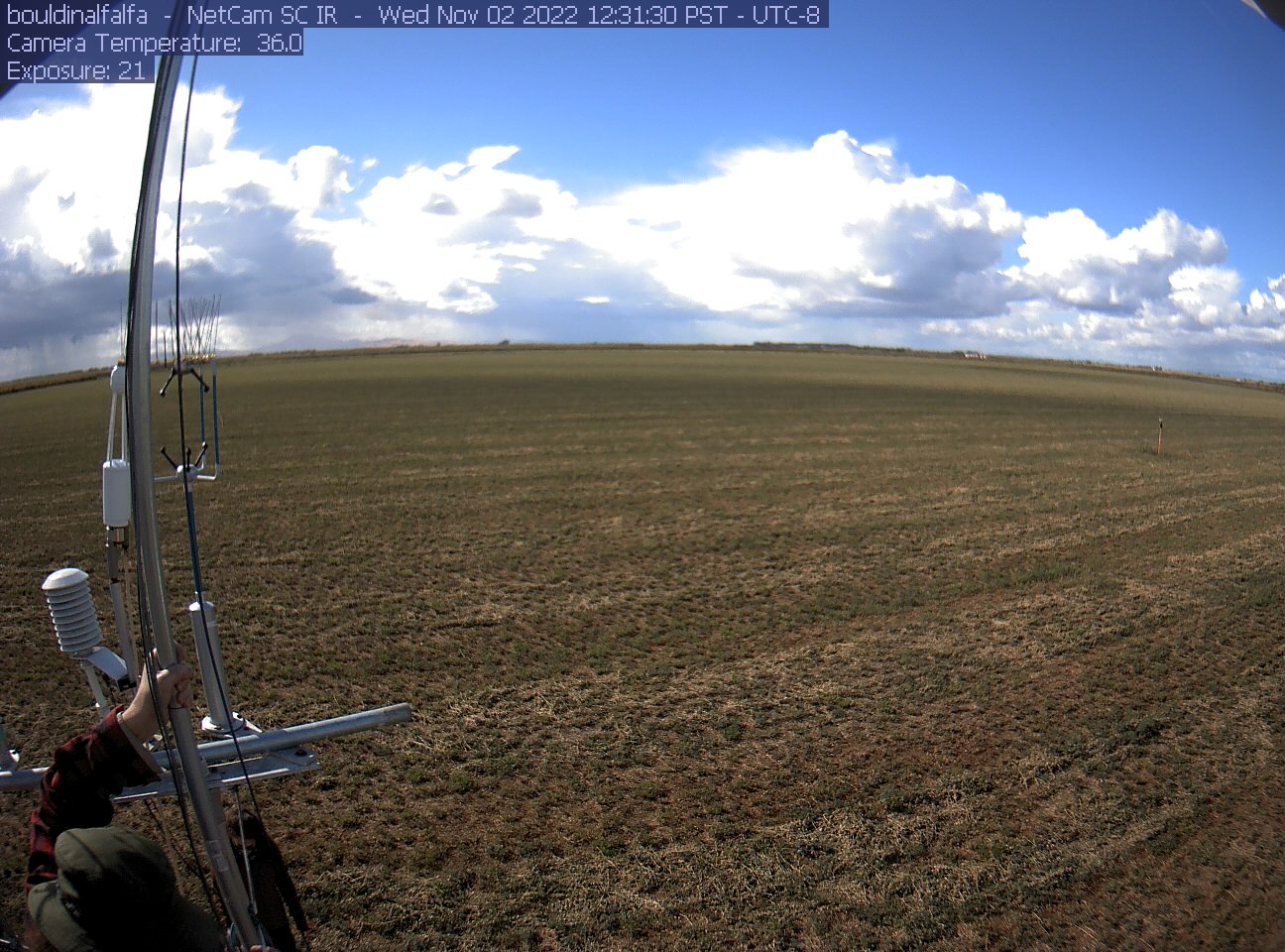 |
| 6756 | 20240625HS_Trekking.jpg Robert and Irene trekking into the wetland. We are trying to relocate HSM_8 to take its GPS point. Either we did not find the exact point, or we could not find the tall, thin, green garden stake we used to mark the location. So the garden stake is still in there somewhere. |
Hill Slough | 2024-06-25 14:47:47 | 1920x1440 | iPhone 14 Pro | 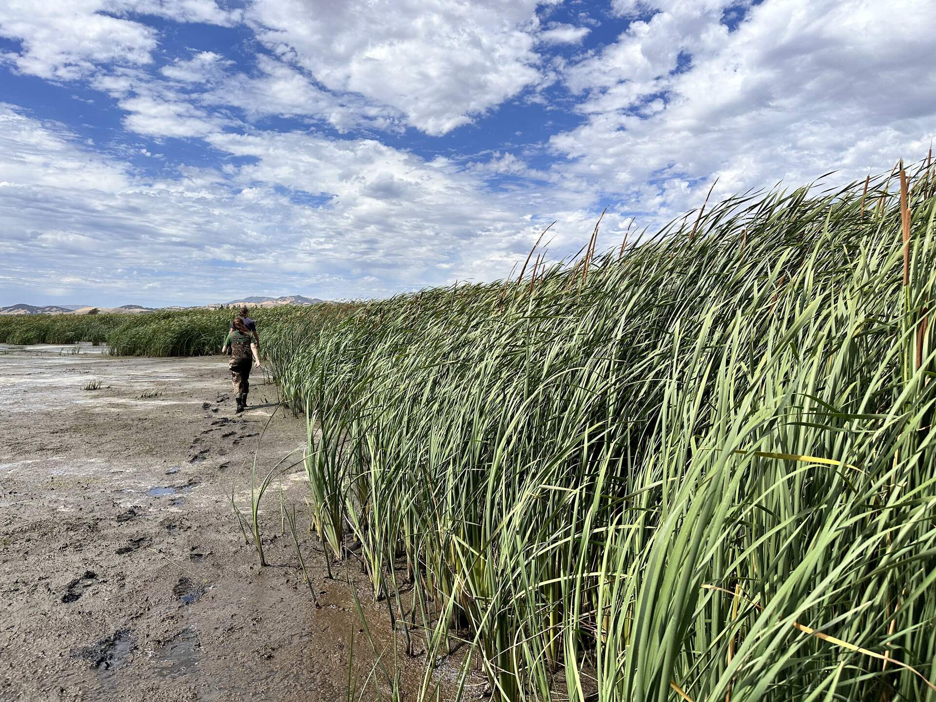 |